Author: Julien L’Hermet

  • Daily Life and Routines in Gerasa (1-200 AD)

    Daily Life and Routines in Gerasa (1-200 AD)

    Previous: “Social Classes and Demographics in Gerasa

    Note: This article combines historical evidence from approximately 1-200 AD to provide a comprehensive view of daily life in Gerasa during the early Roman Imperial period.


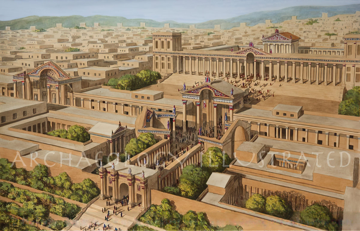
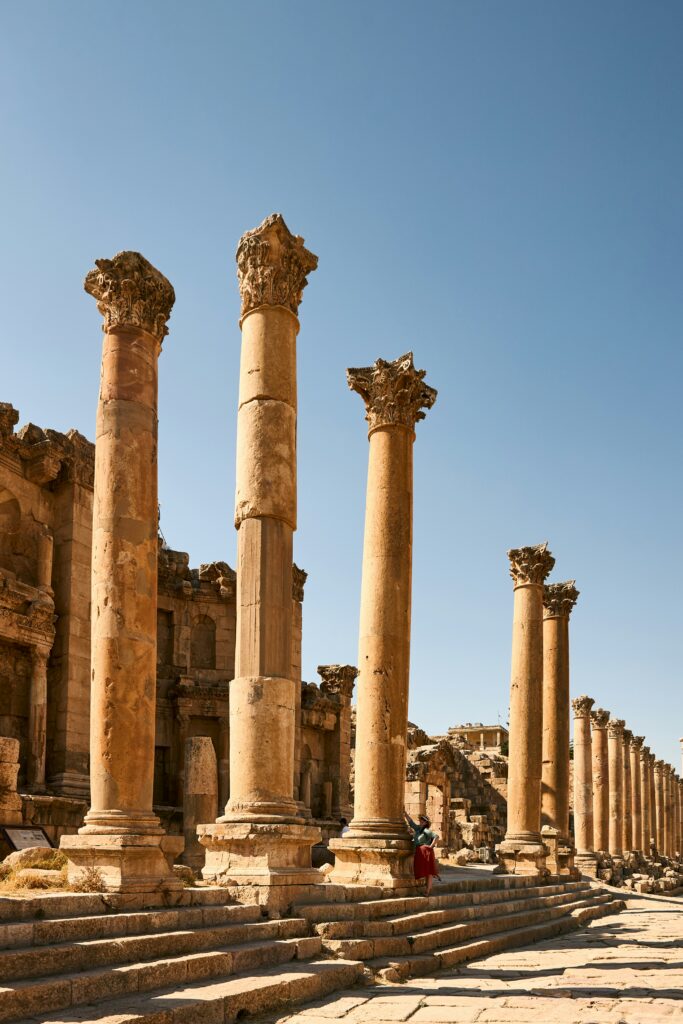
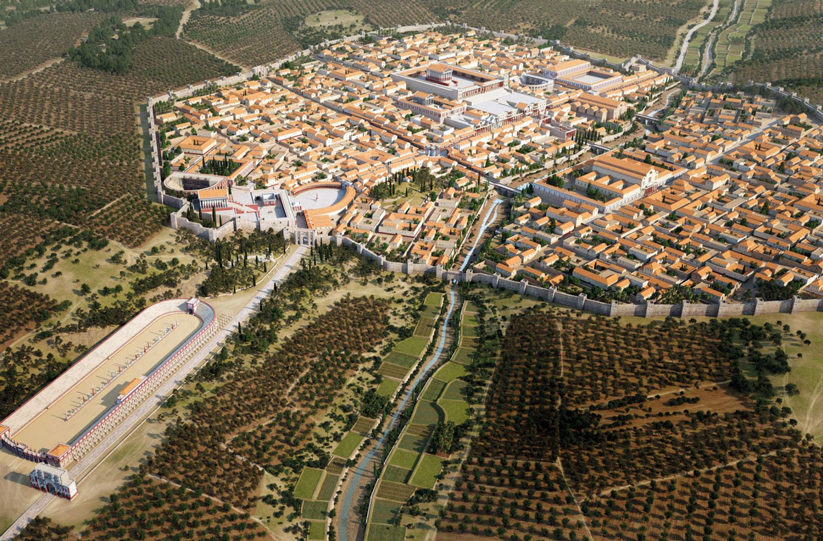
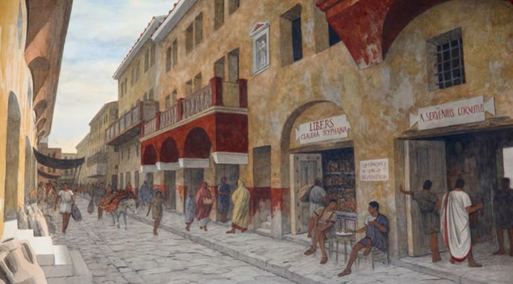
    The streets of ancient Gerasa bustled with activity from dawn until dusk, filled with people going about their daily routines. From merchants setting up their stalls in the marketplace to priests preparing for rituals at the temples of Zeus and Artemis, the city pulsed with life. Drawing from archaeological evidence, inscriptions, and comparative studies of nearby Roman cities, we can reconstruct much about the daily experiences of Gerasenes during the first two centuries AD.

    Food and Dining Customs

    Daily Sustenance

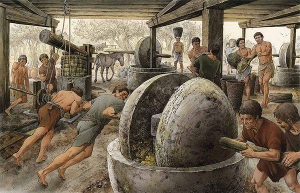
    The diet of Gerasa’s inhabitants varied significantly depending on social status, but certain staples formed the foundation of most meals. Archaeological evidence from the site reveals that wheat, barley, olives, and various fruits were dietary mainstays. Olive cultivation was particularly important in the region, as evidenced by the primitive olive mills discovered in excavations.

    For the average Gerasene, the day typically began with a simple breakfast (ientaculum) consisting of bread dipped in wine, perhaps accompanied by olives, cheese, or dried fruit. The midday meal (prandium) might include more bread, vegetables, cheese, and occasionally fish or meat for those who could afford it. The evening meal (cena) was the most substantial, especially for wealthier families who might enjoy several courses and entertain guests.
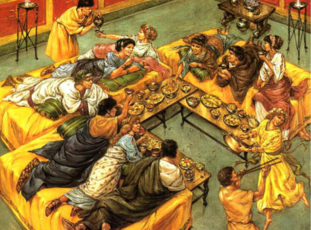
    Dining Practices

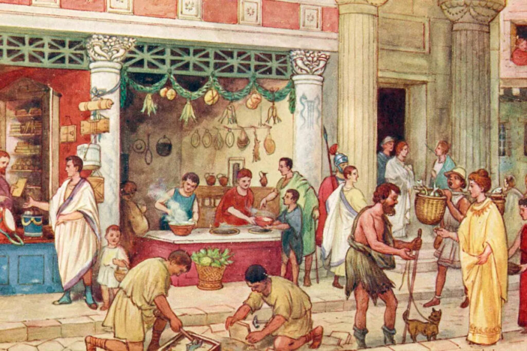
    Wealthy households in Gerasa adopted Greco-Roman dining customs, reclining on couches (triclinia) around a central table while being served elaborate meals. These formal dining areas have been identified in some of the larger domestic structures excavated in the city. The “Dancing Satyr holding Dionysus’ babe” statue fragment discovered in Gerasa suggests the importance of Dionysian themes in elite dining contexts, where wine consumption was central to socializing.

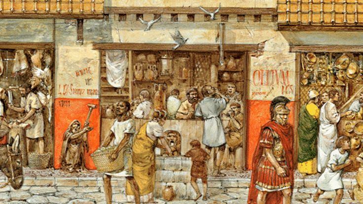
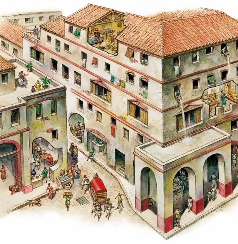
    For most inhabitants, however, dining was a simpler affair. Families gathered around low tables or simply sat together in the main room of their homes. Meals were typically eaten with the hands or with spoons, with bread often serving as both food and utensil to scoop up stews and sauces.

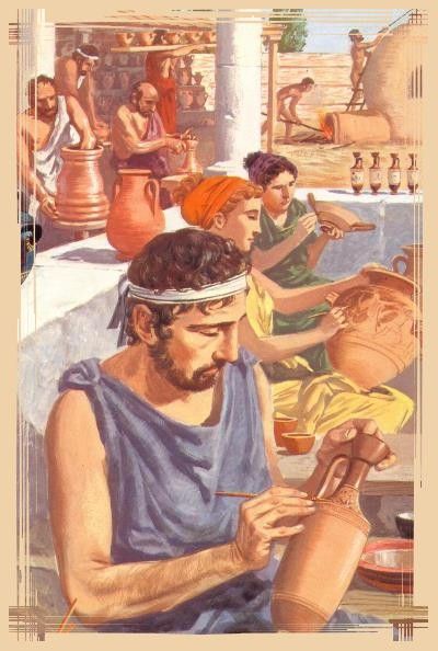
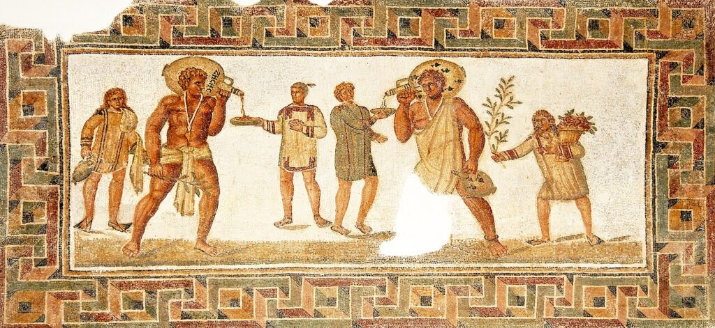
    Water mixed with wine was the common beverage, with the quality of wine varying greatly. The presence of numerous ceramic vessels and amphorae found throughout excavations indicates widespread liquid storage and consumption. Local pottery production was significant to Gerasa’s economy, providing containers for food and drink.

    -> Learn more about the economic foundations of Gerasa in our article “Economic Life in Gerasa”

    Clothing and Personal Appearance

    Everyday Attire

    Clothing in Gerasa reflected both practical needs and cultural influences. The Mediterranean climate, with its hot summers and mild winters, dictated lightweight garments for much of the year, with additional layers during cooler months.

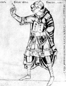
    For men, the basic garment was the tunic (chiton in Greek or tunica in Latin), a simple rectangular cloth folded and sewn at the shoulders and sides, reaching to the knees or ankles depending on the style. Over this, free citizens might wear a toga for formal occasions, though this cumbersome garment was increasingly reserved for official functions. For everyday wear, a cloak (himation in Greek or pallium in Latin) was more practical.

    Women typically wore floor-length tunics (stola), often belted at the waist, with a stole (palla) draped over the shoulders when in public. The quality of fabric and presence of decorative elements signaled social status. Archaeological finds, including small bronze pins and fibulae (brooches), attest to how these garments were fastened.

    Personal Grooming

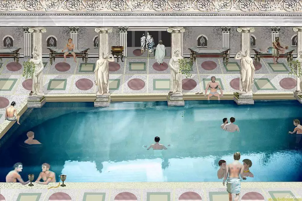
    Personal appearance was important in Gerasa’s society. Inscriptions mentioning public baths indicate their significance for hygiene and socializing. The Great Eastern Baths complex, with its impressive scale, suggests that bathing was a major aspect of daily life for many Gerasenes.

    Evidence from marble sculptural fragments discovered in Gerasa, including the “Aphrodite of Demetrius” and various portraits, provides insights into hairstyles and grooming ideals. Women’s hairstyles typically involved elaborate arrangements of curls and braids, often requiring the assistance of household slaves or family members. Men’s styles varied from short-cropped hair and clean-shaven faces in the early imperial period to longer hair and beards becoming more fashionable under Hadrian and the Antonines.

    Cosmetics and perfumes were used by those who could afford them. The presence of small glass and ceramic containers in archaeological finds suggests the use of imported scented oils and locally produced alternatives.

    -> Discover the public buildings where Gerasenes socialized in our article “Walking Through Ancient Gerasa: A Monument-by-Monument Guide”

    Work and Daily Occupations

    Crafts and Trades

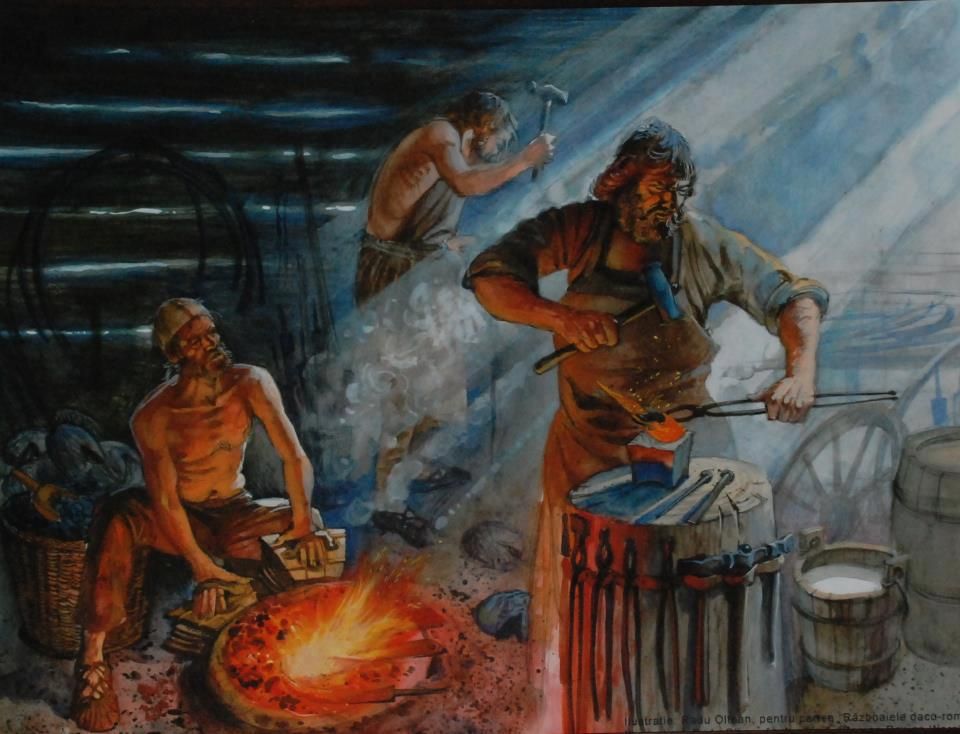
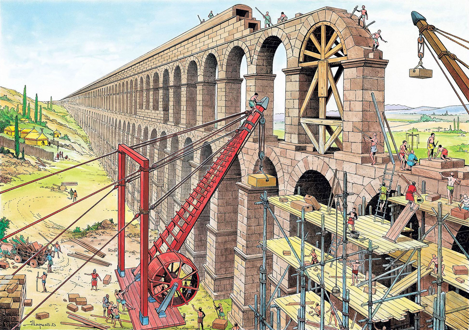
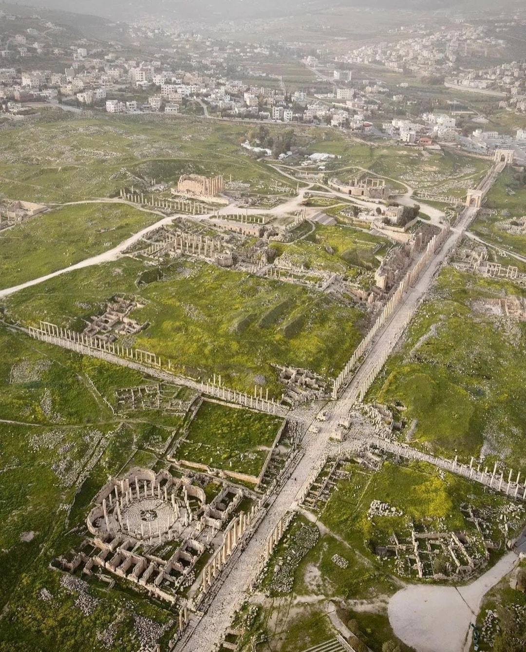
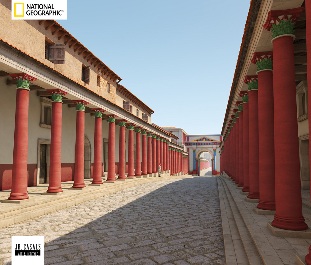
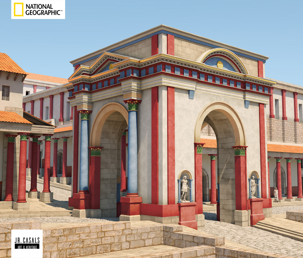
    The workday in Gerasa typically began at dawn and continued until late afternoon. Artisans and craftspeople had workshops throughout the city, often with living quarters above or behind their workspace. Archaeological evidence points to a thriving craft economy, with specialized production in pottery, metalworking, stone carving, and textiles.

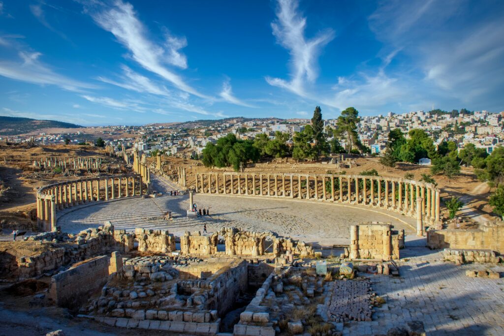
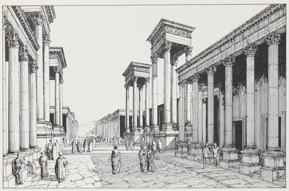
    Inscriptions and architectural remains reveal that Gerasa had a vibrant commercial sector with numerous shops lining the colonnaded streets. The market (agora/macellum) would have been bustling from early morning, with vendors selling produce, meats, fish, breads, and imported goods.

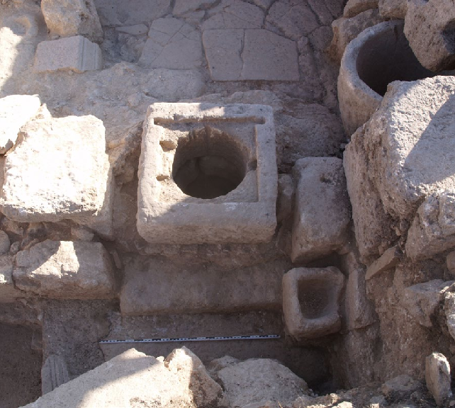
    Of particular interest is evidence of industrial activities in Gerasa. Excavations have identified areas for metalworking, with the discovery of an “exceptionnel atelier de fabrication de grands bronzes” (exceptional workshop for manufacturing large bronze items). This indicates skilled craftspeople were creating substantial bronze works in the city, perhaps including statuary and architectural elements.

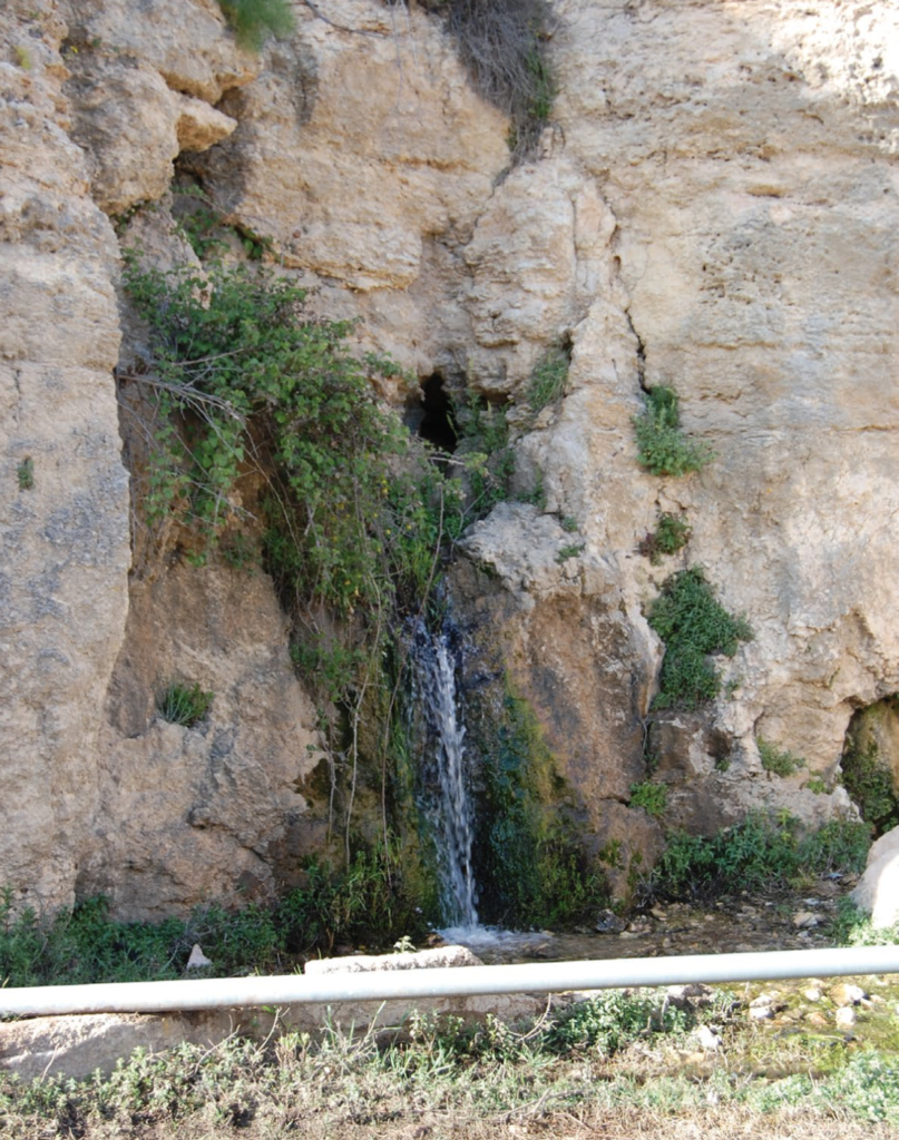
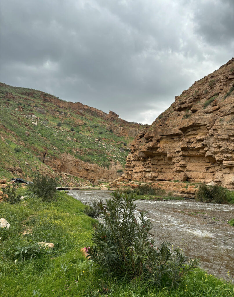
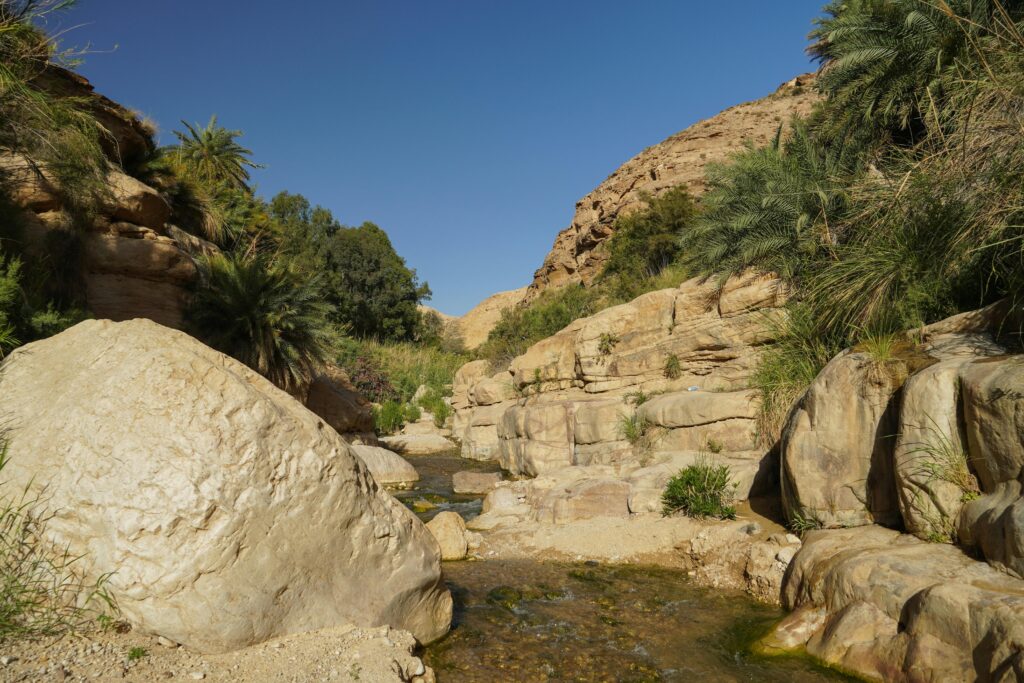
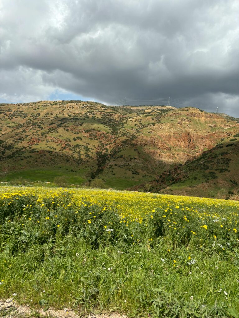
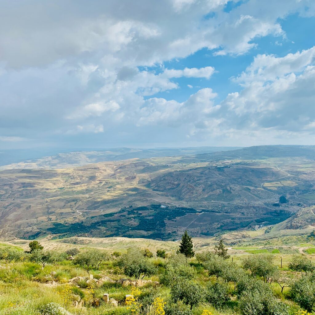
    Agricultural labor was fundamental to Gerasa’s economy, with many residents working fields in the surrounding countryside. An inscription referring to the “gardeners of the upper valley” of the Chrysorrhoas (golden river) suggests organized associations of agricultural workers. These gardeners formed a formal association, indicating they were not merely laborers but likely landowners who participated in the city’s socio-political life.

    Professional Services

    Beyond crafts and agriculture, Gerasa supported numerous other professions. Inscriptions mention various civic officials, including agoranomes (market overseers) and astynomes (responsible for streets and city maintenance). The presence of these officials suggests regulated commercial and urban activities.

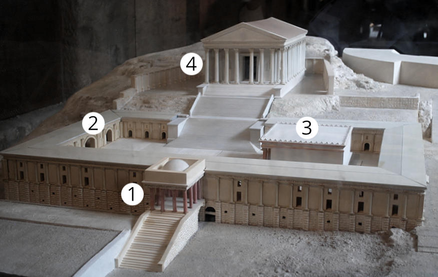
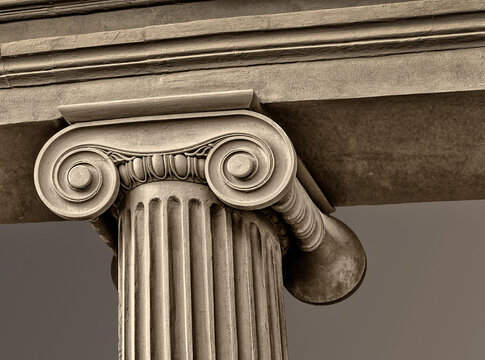
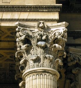
    The extensive architectural remains throughout the city attest to active construction trades, employing architects, stonemasons, and laborers. One notable architect, Diodoros, son of Zebedos, is specifically mentioned in inscriptions as the designer of the innovative vaulted corridors and propylaea of the lower court of the Zeus Olympios sanctuary.

    -> Explore the political structure that governed these professions in our article “Governance and Administration in Gerasa”

    Leisure and Entertainment

    Public Spectacles

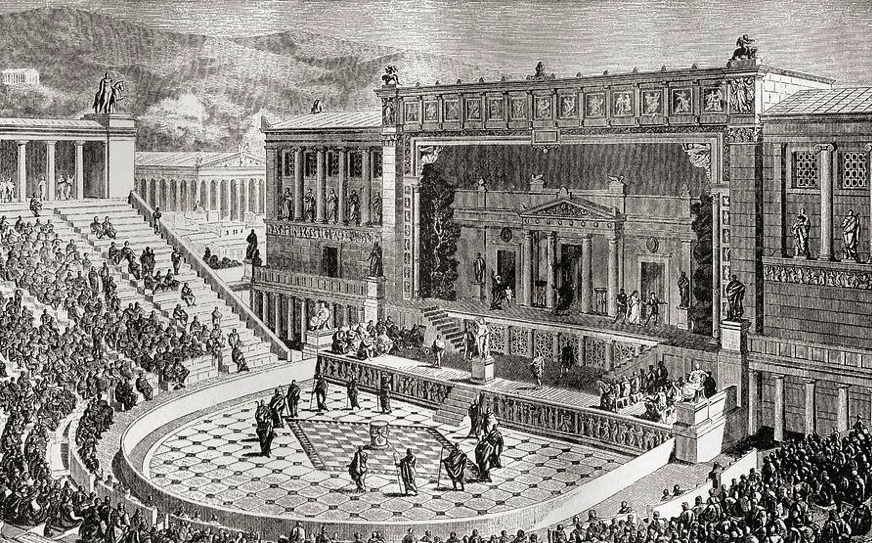
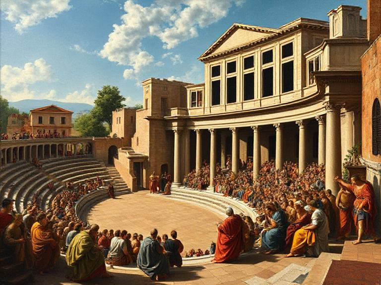
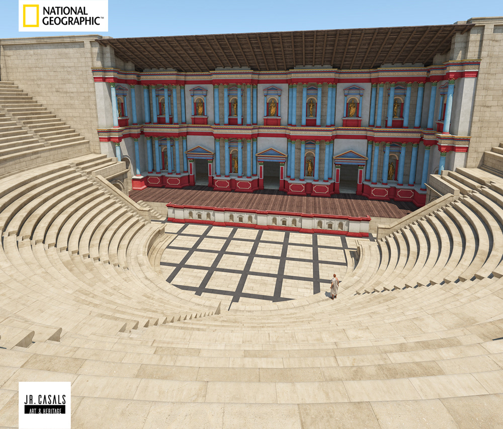
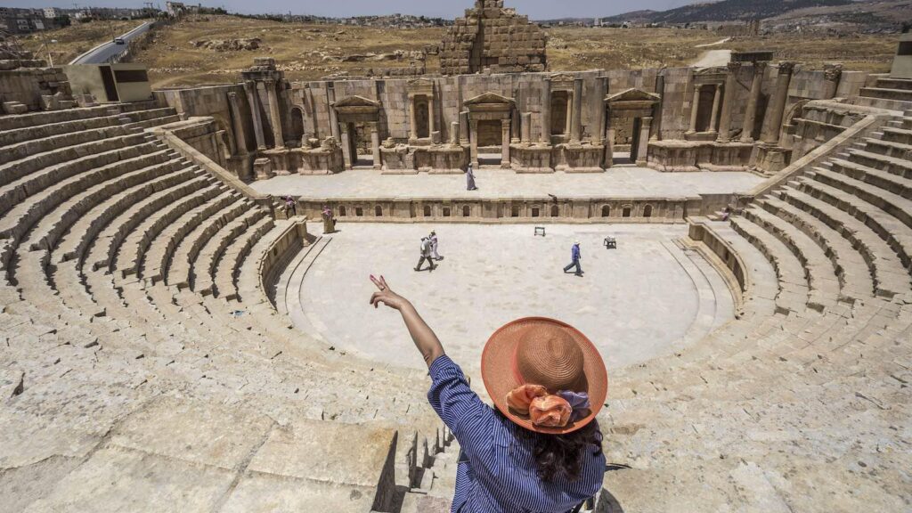
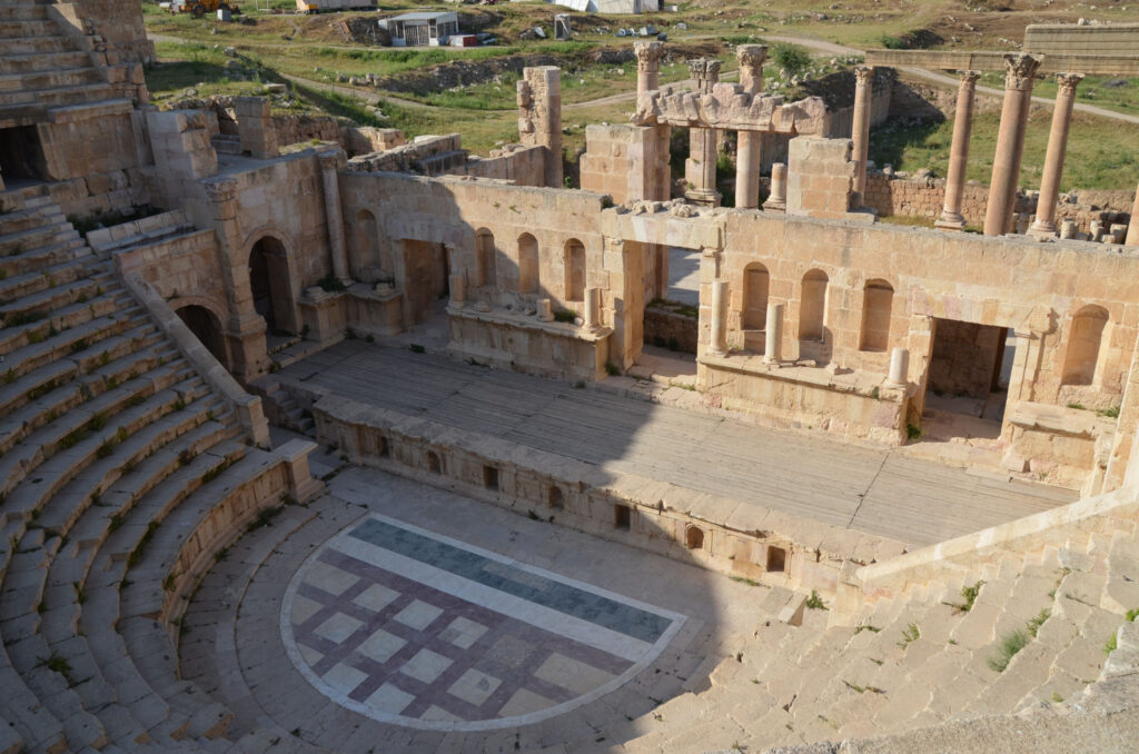
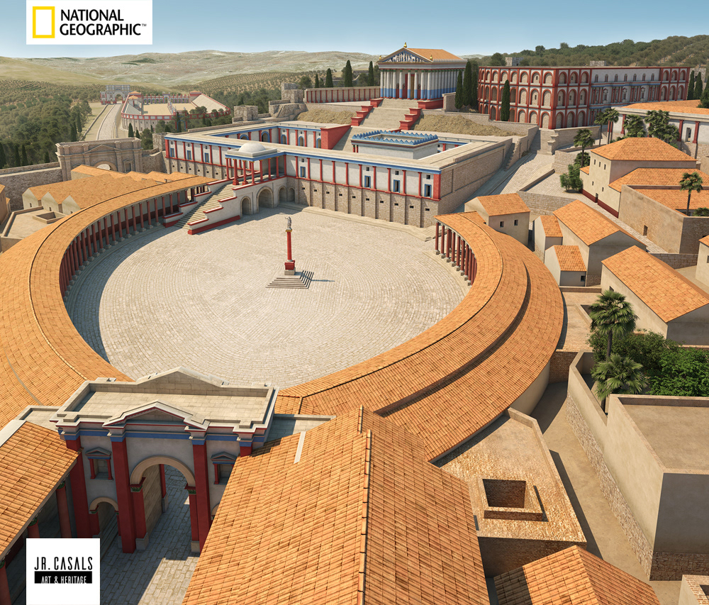
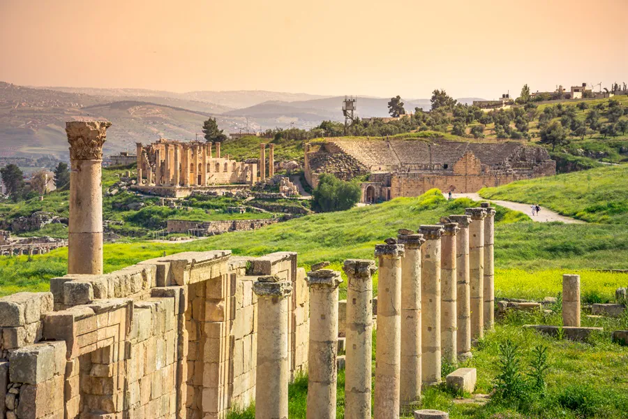
    When not working, Gerasenes had various leisure activities available to them. The well-preserved South Theater, with its 32 rows of seats accommodating approximately 3,000 spectators, hosted performances of Greek and Roman dramatic works. The North Theater, though smaller, likely served both as an odeion (covered theater for musical performances) and a bouleuterion (council chamber).

    Inscriptions and architectural evidence also suggest that the hippodrome hosted chariot races and other spectacles. These events would have been major social occasions, drawing crowds from throughout the city and surrounding countryside.

    Religious Festivals

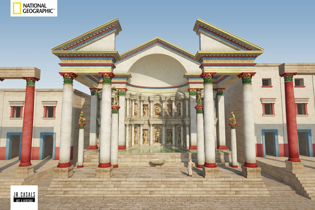
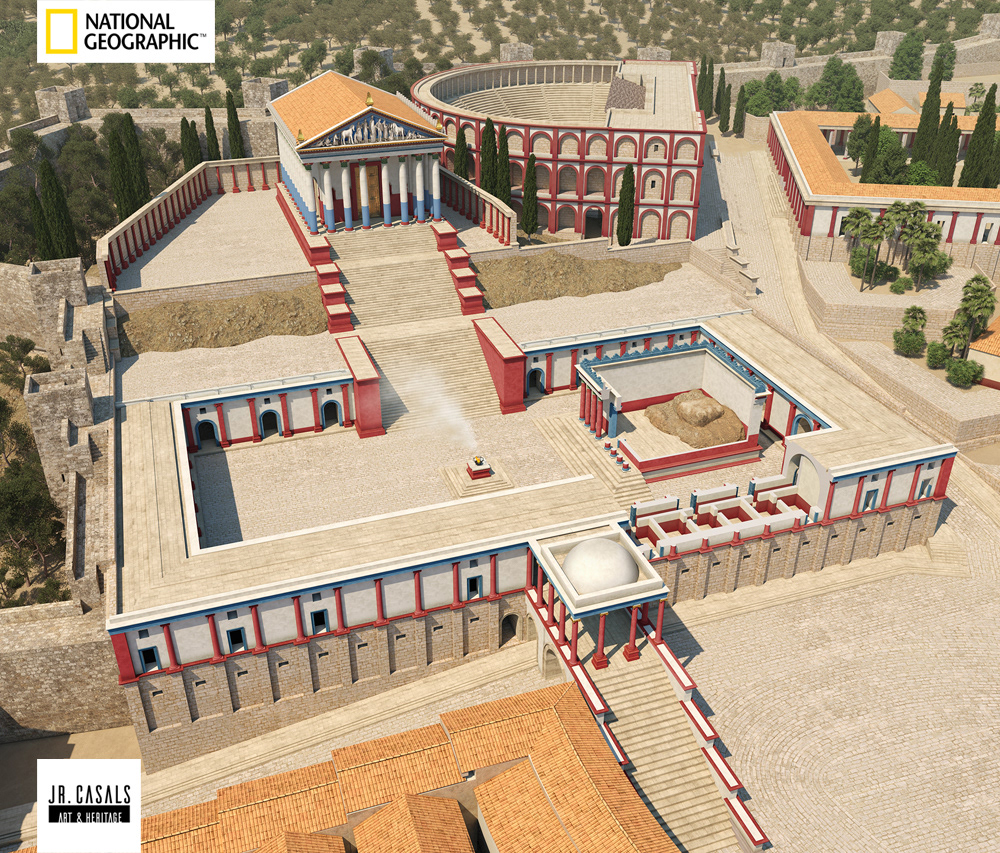
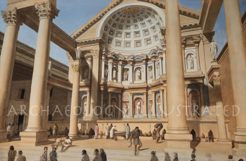
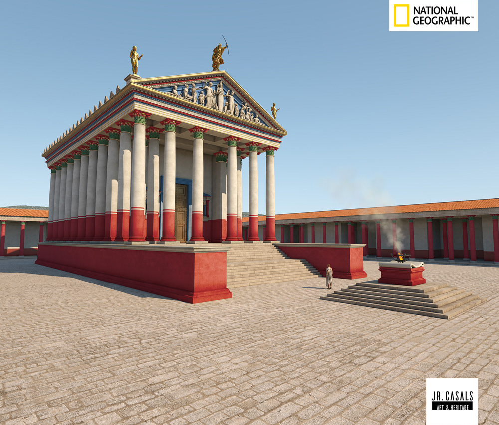
    Religious festivals marked the calendar in Gerasa, providing both spiritual observance and entertainment. The sanctuary of Zeus Olympios and the later Temple of Artemis were centers for major civic celebrations.

    Although specific details of Gerasa’s festival calendar are not fully documented, comparative evidence from other cities in the region suggests these would have included processions, sacrifices, feasting, and competitions. The discovery of a courtyard with a fountain near the temple of Zeus, along with an inscription referencing the “miracle of turning water into wine,” indicates some form of public religious festival where this transformation was enacted annually.

    Private Pastimes

    In private settings, board games were popular pastimes. Though specific gaming pieces from Gerasa are not extensively documented in the available sources, comparative evidence from the wider region suggests games like latrunculi (similar to chess) and dice games were common entertainment.

    For the educated elite, literary pursuits were important. The discovery of various Muse statues in Gerasa, including Melpomene (the muse of tragedy) and other identifiable muses, suggests cultural appreciation of poetry, music, and literature. These statues may have decorated a Museion (shrine to the Muses) or another cultural institution in the city.

    -> Discover more about religious practices in our upcoming article “Religious Landscape of Gerasa”

    Daily Life Across Social Strata

    Elite Experiences

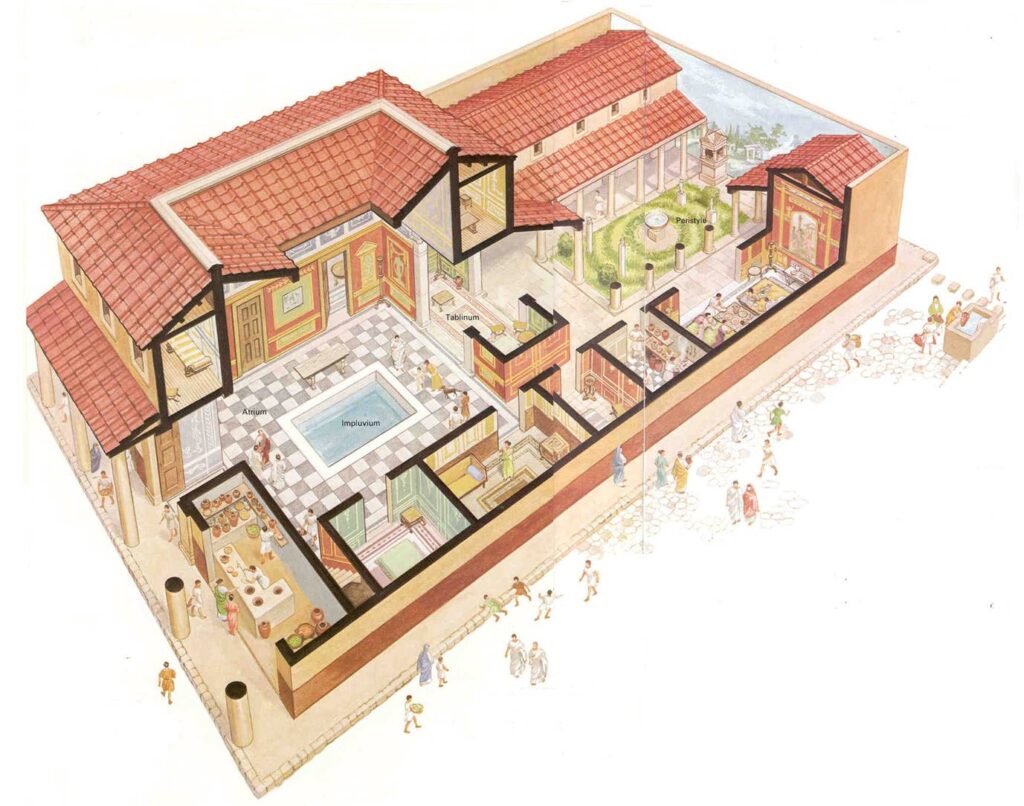
    The daily life of Gerasa’s elite differed markedly from that of the common people. Wealthy citizens might begin their day with clients visiting their homes seeking patronage and support, following the Roman clientage system. Their days could be filled with civic duties, business oversight, and social engagements.

    Archaeological evidence of elite residences in Gerasa is limited in the current excavations, but the quality of imported marble, mosaic floors, and architectural elements suggests considerable private wealth. The donation of public monuments by private citizens, such as “Demetrios, son of Apollonios,” who is recorded as having donated “the construction” to the sanctuary of Zeus as a former priest of Augustus, demonstrates the civic engagement of the wealthy.

    Common Experiences

    For the majority of Gerasa’s inhabitants, daily life revolved around work, family, and community. Living in simpler dwellings, often apartments or modest houses, they would share communal facilities like fountains for water collection.

    Children likely received varying levels of education depending on their social status. While formal schools are not specifically documented in the available evidence from Gerasa, the presence of inscriptions throughout the city suggests literacy among at least the upper and middle strata of society.

    Conclusion

    The daily life of Gerasa’s inhabitants during the first two centuries AD reveals a vibrant, multicultural community adapting Greco-Roman practices to local conditions. From the food they ate to the clothes they wore, from their working hours to their leisure activities, Gerasenes participated in the broader cultural koine of the Roman East while maintaining distinctive local traditions.

    Archaeological evidence continues to expand our understanding of everyday life in this important Decapolis city. Each new excavation, inscription, and artifact adds detail to our picture of a thriving urban center where diverse peoples came together under Roman rule, creating a unique cultural mosaic at this crossroads of civilizations.


    Disclaimer:

    All images used in this article are the property of their respective owners. I do not claim ownership of any images and provide proper attribution and links to the original sources when applicable. If you are the owner of an image, please contact us so I can add your information or remove it if you wish.

    Sources:

    • “Official Guide to Jerash” with plan by Gerald Lankester
    • “The Chora of Gerasa Jerash” by Achim Lichtenberger and Rubina Raja
    • “Jarash Hinterland Survey” by David Kennedy and Fiona Baker
    • “Antioch on the Chrysorrhoas Formerly Called Gerasa” by Achim Lichtenberger and Rubina Raja
    • “Jarash Hinterland Survey — 2005 and 2008” by David Kennedy and Fiona Baker
    • “A new inscribed amulet from Gerasa (Jerash)” by Richard L. Gordon, Achim Lichtenberger and Rubina Raja
    • “Apollo and Artemis in the Decapolis” by Asher Ovadiah and Sonia Mucznik
    • “Onomastique et présence Romaine à Gerasa” by Pierre-Louis Gatier
    • “Dédicaces de statues “porte-flambeaux” (δαιδοῦχοι) à Gerasa (Jerash, Jordanie)” by Sandrine Agusta-Boularot and Jacques Seigne
    • “Un exceptionnel document d’architecture à Gérasa (Jérash, Jordanie)” by Pierre-Louis Gatier and Jacques Seigne
    • “Zeus in the Decapolis” by Asher Ovadiah and Sonia Mucznik
    • “The Great Eastern Baths at Gerasa Jarash” by Thomas Lepaon and Thomas Maria Weber-Karyotakis
    • “Architectural Elements Wall Paintings and Mosaics” by Achim Lichtenberger
    • “Glass Lamps and Jerash Bowls” by Rubina Raja
    • “Water Management in Gerasa and its Hinterland” by David D. Boyer
    • “Hellenistic and Roman Gerasa” by Rubina Raja
  • Economic Life in Gerasa: Commerce and Trade in a Decapolis City

    Economic Life in Gerasa: Commerce and Trade in a Decapolis City

    Previous: “Social Classes and Demographics in Gerasa

    Note: While historical accounts span several centuries, this article presents a cohesive view of economic life in Gerasa during its peak development (1-200 AD), drawing from archaeological evidence and historical records.


    The economic life of ancient Gerasa reflects its status as one of the most prosperous cities of the Decapolis, strategically positioned at the intersection of major trade routes. Archaeological evidence reveals a city that thrived on commerce, manufacturing, and agriculture, with a sophisticated economic infrastructure that supported its monumental architecture and cosmopolitan population.

    A Center of Regional Trade

    Gerasa’s economic success was largely attributable to its favorable geographic position. The city sat at a crucial intersection of north-south and east-west trade routes linking Syria with Arabia and the Mediterranean coast with territories to the east. This advantageous location made Gerasa a natural hub for merchants and traders coming from diverse regions.

    The city’s economic importance was so significant that when the province of Arabia was formed in 106 AD, Gerasa was chosen as the seat of the provincial procurators while Bostra served as the capital. This administrative arrangement speaks to Gerasa’s commercial prominence, as procurators were primarily concerned with financial administration and tax collection.

    The Chrysorrhoas River (aptly named the “Gold River”) was instrumental to Gerasa’s prosperity, providing water for agriculture and supporting various industries. The fertile land along its banks, particularly between Gerasa and Suf, was intensively cultivated, supporting what inscriptions refer to as “gardeners of the upper valley.” An inscription found in the North Theater references this organization of agriculturalists, suggesting they were more than simple gardeners – they were significant landowners who participated in the socio-political life of the city.

    -> Learn more about how the Chrysorrhoas River shaped the city in my article “Physical Geography of Gerasa and Surroundings

    Industries and Manufacturing

    Archaeological evidence reveals a diverse manufacturing sector that supported Gerasa’s economy and provided goods for both local consumption and export.

    Pottery Production

    The ceramic industry was particularly significant, with most pottery used in Gerasa being locally produced. Excavations have uncovered evidence of pottery workshops with various types and styles being manufactured, including the distinctive “Jerash Bowls” introduced in the later Roman period. These fine wares indicate the presence of skilled craftsmen and a market for luxury goods.

    The capacity for large-scale pottery production suggests an export trade to surrounding regions, although the exact extent of this trade awaits further archaeological confirmation. The presence of some imported ceramic wares, though limited, indicates commercial connections with other Mediterranean regions.

    Metallurgy and Stoneworking

    Metallurgical activities were another important component of Gerasa’s economy. Excavations have revealed evidence of metal workshops within the city, where bronze and iron were worked into utilitarian objects, decorative items, and construction materials. An exceptional discovery was made in the sanctuary of Zeus, where evidence of a workshop for producing large bronze statues was found.

    Stonecutting and masonry represented another major industry. The abundant local limestone served as the primary building material for the city’s impressive architecture. Quarries around Gerasa show evidence of extensive stone extraction activities, with different qualities of limestone being used for different purposes. The soft whitish limestone was used for general construction, while harder varieties were reserved for more important architectural elements.

    The scale of public building projects in Gerasa would have required a substantial workforce of skilled and unskilled laborers, from architects and master masons to general construction workers. This construction economy was likely one of the city’s major employers during its periods of monumental building work.

    Olive Oil Production

    Olive cultivation and oil production formed a cornerstone of Gerasa’s agricultural economy. Archaeological evidence of olive presses has been discovered in the immediate vicinity of the city and throughout its territory. One particularly notable find was a subterranean multi-chambered site containing the remains of an olive oil press, which had apparently been converted from a former tomb.

    The production of olive oil would have not only provided a staple food and lamp fuel for local consumption but also an important export commodity. The durable nature of olive oil made it suitable for long-distance trade, and the reputation of Levantine olive oil was high throughout the Roman Empire.

    -> Discover more about the physical structures that housed these industries in our article “Urban Layout of Gerasa (1-200 AD)

    Commerce and Market Life

    The commercial heart of Gerasa was concentrated along its colonnaded street and in specialized market areas. The imposing Nymphaeum, situated along the main street, was more than a decorative monument – it was a public gathering space where commercial activities would have taken place. Markets were typically situated near major intersections or gates where traffic would naturally concentrate.

    The massive public fountain called the Nymphaeum

    Shops lined the main colonnaded street, housed in uniform structures behind the columns. These standardized commercial spaces, typical of Roman urban planning, would have displayed a wide variety of goods from everyday necessities to luxury items. The diversity of commodities available in Gerasa would have reflected its cosmopolitan nature and connections to wider trading networks. Different sectors of the city may have been dedicated to specific trades or products, following a pattern common in Roman provincial cities.

    The macellum or marketplace would have been the center for daily commercial activity, where foodstuffs, household goods, and other commodities changed hands. The official responsible for overseeing market activities was the agoranome, a position attested to in inscriptions from Gerasa. These officials were tasked with ensuring fair trade practices, regulating weights and measures, and possibly overseeing public lighting – a key aspect of enabling commerce beyond daylight hours.

    Currency and Financial Systems

    The monetary system of Gerasa followed the standard Roman provincial pattern while maintaining some local distinctiveness. The city began minting its own bronze coins during the reign of Nero in 67/68 AD, coinciding with the First Jewish War. This timing suggests that the presence of military units in the region created a need for small change for local transactions.

    Coins in Gerasa, from 54AD to 578AD

    The earliest coins from Gerasa featured depictions of Artemis, Zeus, or the city’s Tyche (personified fortune) on the reverse, while the obverse typically displayed the emperor’s portrait. These coins express civic pride and religious affiliations while acknowledging Roman authority. Particularly notable are coins showing Artemis identified with Tyche wearing a mural crown (corona muralis), emphasizing her role as the city’s protector.

    Tyrian Shekel coin used in regional commerce

    For larger transactions, silver coins from other mints would have been used, particularly Tyrian silver, which played an important role in regional commerce and was accepted for the Temple Tax in Jerusalem before 70 AD. After the constitutio Antoniniana of 212 AD granted Roman citizenship to nearly all free inhabitants of the empire, there was a significant increase in persons bearing the name Marcus Aurelius in Gerasa, reflecting this major legal and economic change.

    Banking activities and money-changing would have been essential services in a commercial center like Gerasa. Although direct evidence for banking facilities has not been discovered, the cosmopolitan nature of the city and its commercial importance suggest they must have existed, likely in the vicinity of the main market areas.

    Trade Networks and External Relations

    Gerasa’s prosperity depended on extensive trade networks connecting it to other urban centers in the region and beyond. The Decapolis cities formed a natural commercial network, with goods and people moving freely between them. Beyond this regional network, Gerasa maintained commercial connections with the Mediterranean coast, Arabia, and likely Parthian territories to the east.

    The diversity of imported goods found in archaeological excavations tells us about Gerasa’s external trade connections. Marble architectural elements and statuary were imported from quarries in Asia Minor, Greece, and Egypt, indicating luxury trade with distant regions. Although most pottery was locally produced, some imported fine wares have been discovered, suggesting connections to production centers in other parts of the empire.

    Epigraphic evidence reveals that prominent Gerasene citizens held positions of importance in other cities, including Rome itself, facilitating commercial and political networks beneficial to Gerasa’s economy. The cosmopolitan composition of the city, with its Greek, Roman, Arab, and Jewish elements, further enhanced its capacity to engage in far-reaching trade networks.

    Conclusion

    The economic life of Gerasa presents a picture of a prosperous provincial city deeply integrated into regional and empire-wide commercial networks. Its strategic location, fertile agricultural land, and diverse manufacturing sectors created a resilient economy that supported monumental construction projects and a sophisticated urban lifestyle.

    Archaeological evidence continues to expand our understanding of Gerasa’s economic systems, revealing a city whose commercial vitality made it one of the most important urban centers in the region. This economic foundation was essential to Gerasa’s cultural achievements and its distinctive identity within the broader context of the Roman provincial world.


    Disclaimer:

    All images used in this article are the property of their respective owners. I do not claim ownership of any images and provide proper attribution and links to the original sources when applicable. If you are the owner of an image, please contact us so I can add your information or remove it if you wish.

    Sources:

    • “Official Guide to Jerash” with plan by Gerald Lankester
    • “The Chora of Gerasa Jerash” by Achim Lichtenberger and Rubina Raja
    • “Jarash Hinterland Survey” by David Kennedy and Fiona Baker
    • “Antioch on the Chrysorrhoas Formerly Called Gerasa” by Achim Lichtenberger and Rubina Raja
    • “Jarash Hinterland Survey — 2005 and 2008” by David Kennedy and Fiona Baker
    • “A new inscribed amulet from Gerasa (Jerash)” by Richard L. Gordon, Achim Lichtenberger and Rubina Raja
    • “Apollo and Artemis in the Decapolis” by Asher Ovadiah and Sonia Mucznik
    • “Onomastique et présence Romaine à Gerasa” by Pierre-Louis Gatier
    • “Dédicaces de statues “porte-flambeaux” (δαιδοῦχοι) à Gerasa (Jerash, Jordanie)” by Sandrine Agusta-Boularot and Jacques Seigne
    • “Un exceptionnel document d’architecture à Gérasa (Jérash, Jordanie)” by Pierre-Louis Gatier and Jacques Seigne
    • “Zeus in the Decapolis” by Asher Ovadiah and Sonia Mucznik
    • “The Great Eastern Baths at Gerasa Jarash” by Thomas Lepaon and Thomas Maria Weber-Karyotakis
    • “Architectural Elements Wall Paintings and Mosaics” by Achim Lichtenberger
    • “Glass Lamps and Jerash Bowls” by Rubina Raja
    • “Water Management in Gerasa and its Hinterland” by David D. Boyer
    • “Hellenistic and Roman Gerasa” by Rubina Raja
  • Social Classes and Demographics in Gerasa

    Social Classes and Demographics in Gerasa

    Previous: “Governance and Administration in Gerasa

    Note: This article synthesizes archaeological and historical evidence spanning from approximately 1 AD to 200 AD to present a comprehensive picture of Gerasa’s social structure during the early Roman imperial period.


    Walking through the bustling streets of ancient Gerasa, a visitor would encounter a remarkable tapestry of peoples, languages, and social classes. Far from a homogeneous society, Gerasa represented a complex social ecosystem where Greek-speaking elites, Roman officials, local merchants, craftspeople, and laborers all interacted within the framework of imperial Roman rule. Understanding this social landscape provides crucial context for appreciating how Gerasenes lived, worked, and worshipped during the city’s golden age.

    The Elite: Civic Notables and Priestly Families

    At the apex of Gerasene society stood a relatively small group of wealthy and influential families who dominated civic affairs and religious life. Epigraphic evidence reveals that these elites often held multiple civic positions, served as priests, and acted as benefactors who financed major public works.

    Inscriptions discovered throughout Gerasa, particularly in the Sanctuary of Zeus, provide glimpses into this upper echelon. Notable among these is a Greek inscription from the early 1st century AD that records the donation of 10,000 drachmas (~$2.5 millions) by a certain Titus Pomponius of the tribe Scaptia and his wife Manneia Tertulla for the construction of buildings in the sanctuary. This substantial sum far exceeded the typical donations of 1,500 drachmas (~$370,000) made by local gymnasiarchs, highlighting the vast wealth gap between the highest elites and other notable citizens.

    The elite class was comprised primarily of Hellenized families who, despite their adoption of Greek culture and language, often had local Semitic origins. Names documented in inscriptions frequently combine Greek and Semitic elements, suggesting a blended cultural identity. Family connections were paramount, with several generations serving in prominent positions. For example, an inscription from 9/10 AD mentions Démétrios, son of Apollônios and grandson of Daisôn, identified as “former priest of Augustus,” while another from later in the century refers to Sarapiôn, son of Apollônios and grandson of Démétrios, who served as priest of Nero.

    The elite jealously guarded their status through strategic marriages and by monopolizing key religious and civic offices. Their residences, mostly unexcavated but surely grand by local standards, would have occupied prime locations in the city, featuring peristyle courtyards, decorated reception rooms, and private bathing facilities.

    -> Learn more about Gerasa’s religious landscape in my “Religious Landscape of Gerasa” article.

    Roman Presence: Officials, Veterans, and Merchants

    The Roman presence in Gerasa formed a distinct social group. While relatively small in number, their influence was substantial. Three main categories of Romans can be identified:

    First were the imperial officials and administrators. After Gerasa was incorporated into the newly created province of Arabia in 106 AD, the city became the seat of the provincial procurator – the official responsible for financial administration – even though the provincial capital was at Bostra. Inscriptions document numerous procurators and their staff, including freedmen who served as clerks, record-keepers, and messengers in the procuratorial office.

    Second were military veterans, who after completing their service often settled in provincial cities like Gerasa. Epigraphic evidence shows these veterans frequently rose to become influential members of local society. Several inscriptions mention individuals bearing Roman names who are identified as “former centurions” and who subsequently held civic positions. One inscription refers to a certain Flavius Munatius, a local councilor (bouleute) and former priest, who was also the son of a centurion and had attained equestrian rank. These veterans and their descendants formed an important bridge between Roman and local interests.

    Third were Roman merchants and businesspeople drawn to Gerasa’s commercial opportunities. Although less visible in the epigraphic record, their presence is attested indirectly through imported goods found in archaeological contexts.

    The Roman presence introduced new architectural forms, religious practices, and social customs to Gerasa, contributing to its increasingly cosmopolitan character during the 1st and 2nd centuries AD.

    -> Discover more about Roman architectural influences in my Walking Through Ancient Gerasa: A Monument-by-Monument Guide article.

    The Middle Classes: Merchants, Craftspeople, and Freedmen

    Between the elite and the laboring poor existed a substantial middle stratum of Gerasene society. This diverse group included merchants, shopkeepers, skilled craftspeople, and successful freedmen.

    Archaeological evidence for this middle class comes primarily from small workshops and commercial spaces that lined Gerasa’s colonnaded streets. These typically included a front shop area opening onto the street with living quarters in the back or on an upper floor. The owners of these establishments formed the backbone of the urban economy.

    Craftsmanship flourished in Gerasa, with archaeological evidence showing active production of pottery, metalwork, glassware, and textiles. The so-called “Jerash bowls,” distinctive fine pottery with impressed decorations, represent the high quality of local ceramic production during the Roman period. Workshops for stone carving and sculpture production have also been identified, indicating a substantial market for luxury decorative items.

    Inscriptions occasionally mention professional associations or guilds. One notable example refers to the “gardeners of the upper valley” of the Chrysorrhoas, who formed an association that participated in the civic and religious life of the city. Such organizations provided both economic coordination and social solidarity for their members.

    Freedmen (ex-slaves) occupied a complex position in this middle stratum. While some, particularly those formerly owned by wealthy Romans or members of the imperial household, could achieve considerable wealth and status, they remained socially distinct from freeborn citizens. Several inscriptions document imperial freedmen serving in the procurator’s office, some of whom erected monuments or made donations, suggesting they had attained significant means.

    The Lower Classes: Laborers, Slaves, and the Rural Poor

    The lower classes, though forming the numerical majority of Gerasa’s population, are the most poorly documented in both archaeological and epigraphic records. They lived primarily in the city’s less developed quarters, in modest multi-room dwellings built of local limestone, or in the surrounding countryside.

    Urban laborers worked as porters, construction workers, domestic servants, and in other unskilled or semi-skilled capacities. Archaeological evidence for their living conditions is limited, though excavations in the Northwest Quarter of Jerash (Gerasa) have revealed modest domestic structures that may represent their dwellings. These simpler homes lacked the decorative elements and spacious layouts found in elite residences.

    Slavery was an established institution in Gerasa, as throughout the Roman world. Slaves served in various capacities: as domestic servants in wealthy households, as laborers in workshops and on rural estates, and as assistants in the public baths and other municipal facilities. Manumission (the freeing of slaves) was practiced, with several inscriptions recording freed slaves, some of whom achieved positions in the imperial administration.

    The rural poor, living in villages and farms in Gerasa’s territory (chora), formed an essential part of the economic landscape. They cultivated the fertile lands along the Chrysorrhoas valley, producing grain, olives, grapes, and other crops that fed the urban population. Evidence of agricultural installations, including olive oil presses, has been found throughout the region, testifying to the intensive cultivation of the countryside. While these farmers had limited political influence, their economic importance was recognized, as shown by the organization of the “gardeners of the upper valley” mentioned earlier.

    -> Explore more about Gerasa’s agricultural landscape in our “The Decapolis: Ten Semi-Autonomous Cities in Rome’s Shadow “article.

    Ethnic Composition and Cultural Identity

    Gerasa’s population reflected the city’s position at the crossroads of different cultural worlds. Archaeological and epigraphic evidence reveals several distinct ethnic components that contributed to the city’s cultural makeup.

    The Greek-speaking population formed the core of the civic elite. While many were descendents of Hellenized local families rather than ethnic Greeks, they embraced Greek culture, language, and civic institutions. Their cultural dominance is attested by the overwhelmingly Greek character of public inscriptions. Even during the Roman period, Greek remained the primary language of administration and high culture in Gerasa. The cultural aspirations of this group are evident in the city’s architecture, such as the temples, theatres, and other public buildings built in Greco-Roman style.

    The indigenous Semitic population, though often Hellenized to varying degrees, maintained aspects of their pre-Greek cultural identity. Personal names preserved in inscriptions provide the clearest evidence for this population. While Greek names predominate, especially among the elite, Semitic names such as Malchiôn, Zébinas, and Zébédos appear occasionally, suggesting the persistence of local onomastic traditions. The architect of the Sanctuary of Zeus, identified in an inscription as “Diodôros, son of Zébédos, of Gérasa,” exemplifies this cultural blending – a man with a Greek personal name but whose father bore a Semitic name.

    Evidence for a Jewish community in Gerasa comes from various sources. Josephus mentions that during the First Jewish Revolt (66-70 AD), the inhabitants of Gerasa spared their Jewish citizens, indicating a significant Jewish presence in the city. Archaeological confirmation comes from the discovery of a fragment of a Jewish “purity vessel” in the Northwest Quarter, of a type associated with ritual purification practices and likely dating to before 70 AD. This Jewish community would have maintained its distinct religious practices while participating in the broader economic and social life of the city.

    Romans and other western immigrants, though numerically small, brought significant cultural influences. As noted earlier, these included officials, veterans, and merchants. Their presence is marked by Latin inscriptions, which comprise about one-seventh of the epigraphic finds from Gerasa, and by the introduction of distinctly Roman architectural features such as bath complexes.

    Family Structure and Gender Roles

    Gerasene family structure generally followed patterns common throughout the eastern Mediterranean during the Roman period. The family unit typically consisted of a nuclear family – parents and children – though extended family connections remained important, especially among the elite.

    Marriage was the foundation of family life, with marriages arranged to strengthen social ties and secure property. Among the upper classes, marriage alliances were crucial strategies for maintaining status and wealth. Women normally married in their teens, while men married somewhat later. The city’s Greek heritage meant that women had limited public roles, though they could own property and conduct certain kinds of business.

    The epigraphic record provides glimpses of women’s status in Gerasene society. Several inscriptions mention women as donors or dedicants, usually in conjunction with their husbands. For example, the previously mentioned inscription records Manneia Tertulla making a substantial donation alongside her husband Titus Pomponius. Women also appeared as priestesses in certain cults, particularly those dedicated to female deities like Artemis.

    Children were highly valued, as in most ancient societies, with sons particularly prized as heirs and continuers of the family line. Elite families invested significantly in their sons’ education, which would have included Greek literature, rhetoric, and philosophy – skills necessary for participation in civic life. Evidence for formal educational institutions in Gerasa is limited, though the city certainly would have had teachers and perhaps schools similar to those known from other cities in the eastern provinces.

    Family tombs, located in necropolis areas outside the city walls, reflect the enduring importance of family connections even in death. While relatively few funerary inscriptions have been discovered at Gerasa compared to other types of texts, those that exist often emphasize family relationships and lineages.

    Social Mobility and Status Markers

    Despite the hierarchical nature of Gerasene society, some degree of social mobility was possible. The clearest path to advancement was through military service. Several inscriptions document cases where military veterans, particularly centurions, or their descendants achieved positions of prominence in local society, sometimes even attaining equestrian rank.

    Commercial success offered another avenue for advancement. Successful merchants and craftspeople could accumulate wealth that allowed their descendants to pursue more prestigious careers and eventually join the civic elite. The most successful freedmen might also achieve considerable wealth, though social prejudices limited their full acceptance into elite circles.

    Roman citizenship served as an important status marker in Gerasa. Prior to the Constitutio Antoniniana of 212 AD (which granted citizenship to nearly all free inhabitants of the empire), Roman citizenship was relatively restricted. Epigraphic evidence from Gerasa shows that before this universal grant, citizens were predominantly either Romans who had settled in the city or locals who had acquired citizenship through military service or imperial favor.

    The epigraphic record reveals that the gentilice Flavius was particularly common among Gerasene citizens before the wide spread of the Aurelii in the 3rd century. This suggests that many families received citizenship during the Flavian dynasty (69-96 AD), possibly in recognition of the city’s loyalty to Rome during the First Jewish Revolt. The military career appears to have been a privileged means of accessing Roman citizenship in Gerasa, including among notable families.

    Conclusion

    The social landscape of Gerasa between the 1st and 2nd centuries AD reflected both the city’s local cultural heritage and its integration into the wider Roman imperial system. The stratified society – with its elite families, Roman officials, middle-class merchants and craftspeople, and laboring poor – operated within a framework where Greek cultural forms predominated but where multiple ethnic and religious traditions coexisted.

    Understanding this complex social ecosystem provides essential context for appreciating how the people of Gerasa navigated their daily lives, formed identities, and interacted across social boundaries during this pivotal period in the city’s history. Beyond the monumental architecture that dominates the archaeological remains, it was this diverse human community that gave Gerasa its distinctive character as one of the most prosperous cities of the Decapolis.


    Sources: “Onomastique et Présence Romaine à Gerasa” by Pierre-Louis Gatier “Hellenistic and Roman Gerasa” by Rubina Raja “A New Inscribed Amulet from Gerasa (Jerash)” by Richard L. Gordon, Achim Lichtenberger and Rubina Raja “Un Exceptionnel Document d’Architecture à Gérasa (Jérash, Jordanie)” by Pierre-Louis Gatier et Jacques Seigne “Dédicaces de Statues ‘Portes-Flambeaux’ (Δαιδούχοι) à Gerasa (Jerash, Jordanie)” by Sandrine Agusta-Boularot & Jacques Seigne “Water Management in Gerasa and Its Hinterland” by David D. Boyer “The Chora of Gerasa/Jerash” by Achim Lichtenberger & Rubina Raja “New Perspectives on the City on the Gold River: The Danish-German Jerash Northwest Quarter Project 2011–2017” by Achim Lichtenberger and Thomas Maria Weber-Karyotakis “The Great Eastern Baths at Gerasa/Jarash: Report on the Excavation Campaign 2017” by Thomas Lepaon and Thomas Maria Weber-Karyotakis “Apollo and Artemis in the Decapolis” by Asher Ovadiah – Sonia Mucznik “Antioch on the Chrysorrhoas, Formerly Called Gerasa” by Achim Lichtenberger and Rubina Raja “Jarash Hinterland Survey – 2005 and 2008” by David Kennedy and Fiona Baker

  • Governance and Administration in Gerasa

    Governance and Administration in Gerasa

    Previous: “Architectural Features and Building Styles of Gerasa

    Note: This article presents historical elements from Gerasa’s development between the 1st-2nd centuries AD, with some details drawn from structures and institutions that evolved throughout this period.


    The magnificent colonnaded streets and monumental buildings of Gerasa reveal more than just architectural splendor—they reflect a sophisticated system of governance and civic organization. As a member of the prestigious Decapolis, Gerasa operated as a semi-autonomous city under Rome’s protective shadow, balancing local traditions with imperial oversight in ways that shaped every aspect of daily life.

    Political Structure and Administrative Framework

    Gerasa, known formally in some inscriptions as “Antioch on the Chrysorrhoas, formerly called Gerasa,” embodied the Greco-Roman polis model—a self-governing city with its own institutions and a defined territory. The city enjoyed remarkable continuity in its governance structures from the mid-1st century BC through the 2nd century AD, despite changing provincial affiliations.

    When Pompey’s lieutenant Scaurus incorporated Gerasa into the Roman province of Syria in 63 BC, the city marked this event by establishing its own civic era. This date became the reference point for Gerasa’s chronology, appearing on public inscriptions and monuments—a testament to how the city viewed Roman “liberation” as the beginning of a new political identity.

    The most significant administrative change occurred in 106 AD when Emperor Trajan annexed the Nabataean Kingdom and established the province of Arabia. Gerasa, previously part of the province of Syria, was transferred to this new province. Despite this provincial reorganization, the day-to-day governance of the city remained largely in local hands, with oversight from Roman officials.

    -> Learn more about Gerasa’s place within the wider regional network in my article “The Decapolis: Ten Semi Autonomous Cities in Rome’s Shadow

    Civic Institutions and Local Governance

    Archaeological and epigraphic evidence from Gerasa provides valuable insights into its civic administration. The city operated through several key institutions:

    The Boule (City Council)

    The boule or city council formed the cornerstone of local governance. Composed of prominent citizens from the wealthiest families, this council made decisions on civic affairs, finances, and religious matters. An inscription discovered in the Zeus Olympios sanctuary dated to 9/10 AD references “a decree antecedent of the council,” demonstrating the boule’s early establishment and decision-making authority.

    Evidence from the bouleuterion (council chamber) includes inscribed seats with the names of the city’s tribes, indicating that representation in the council was organized along tribal lines. These inscriptions reveal that Zeus, along with other Olympian gods, served as the tutelary divinity for one of the leading urban tribes, underscoring the integration of religious and political structures.

    Civic Magistrates

    Below the council, various magistrates managed specific aspects of city administration:

    • Archons: Senior officials who presided over civic affairs
    • Strategoi: Officials with responsibilities similar to modern city managers
    • Agoranomoi: Market officials who regulated commerce, weights, measures, and possibly public lighting
    • Astynomoi: Officials responsible for streets, public order, and urban infrastructure

    A fascinating inscription from Gerasa mentions that Antonius Marsus, a man of equestrian rank and an epimeletai (supervisor), was active in the city in 231-232 AD. Such officials oversaw public works, including the construction and maintenance of civic monuments.

    The Ecclesia

    While evidence is limited, it’s likely that Gerasa maintained the traditional Greek assembly (ecclesia) where male citizens could gather to hear pronouncements and participate in certain civic decisions, though its real power was probably ceremonial by the Roman period.

    -> Explore the physical setting of these institutions in my article “Walking Through Ancient Gerasa: A Monument-by-Monument Guide

    Relationship with Rome: Provincial Administration

    While Gerasa enjoyed internal autonomy, it operated within the framework of Roman provincial administration. The city’s elite cultivated relationships with Roman governors and officials, often dedicating monuments to demonstrate their loyalty.

    Provincial Leadership

    The province was led by a Roman governor (legatus Augusti pro praetore) headquartered at Bostra, who held military command and supreme judicial authority. Under him served various officials handling specific aspects of provincial administration.

    An intriguing feature of Gerasa’s administration was the presence of procuratorsRoman financial officials—within the city itself, rather than in the provincial capital. Multiple inscriptions discovered in Gerasa mention procurators, both equestrian officials and imperial freedmen, along with subordinates like tabularii (record-keepers) and other staff.

    This unusual arrangement may reflect Gerasa’s previous role as an administrative center within the Decapolis region during the 1st century AD. An inscription found in Thrace mentions an anonymous equestrian officer who served as a prefect or procurator of the Decapolis around 90 AD, suggesting that Gerasa may have maintained its administrative importance even after the provincial reorganization under Trajan.

    Military Presence

    The archaeological record reveals a clear military presence in Gerasa. While the main camp of the Legio III Cyrenaica was at Bostra, detachments were stationed in Gerasa, as evidenced by inscriptions mentioning soldiers and officers of this legion. These forces maintained order, protected the procurator‘s office, and likely supervised the collection of taxes.

    Inscriptions from Gerasa mention centurions and other military personnel who integrated into local society. The family of Flavius Munatius, a council member who held various civic and religious offices, traced its prominence back to a centurion ancestor, illustrating how military service could provide a pathway to civic leadership.

    Citizenship and Social Mobility

    Roman citizenship was relatively rare among Gerasa’s population before the Constitutio Antoniniana of 212 AD (which granted citizenship to all free inhabitants of the empire). Those who did hold citizenship often displayed distinct naming patterns in inscriptions.

    In the pre-212 period, the most common Roman gentilicium (family name) in Gerasa was Flavius, suggesting that many families received citizenship during the Flavian dynasty (69-96 AD). This corresponds to the First Jewish War period, when Gerasa remained loyal to Rome. Archaeological evidence indicates that many citizens with Roman names had military backgrounds, suggesting that service in auxiliary units was a key pathway to citizenship.

    Inscriptions reveal a striking pattern: the gentilice Flavius appears frequently, while Antonine-era names (e.g., Aelius, Aurelius) are comparatively rare. This suggests that after the initial wave of citizenship grants in the late 1st century, fewer Gerasenes acquired Roman citizenship until the universal grant under the emperor Caracalla.

    Civic Euergetism (Benefactors) and Public Works

    A hallmark of Gerasa’s governance was the system of euergetism—civic benefactions by wealthy citizens who funded public buildings and services in exchange for honor and prestige. This mechanism bridged political administration and urban development.

    Numerous inscriptions commemorate these acts of generosity. In the Sanctuary of Zeus, a limestone plaque records the donation of 5,000 drachmas (~$1.2 million in today’s money) each by Titus Pomponius (of the tribe Scaptia) and his wife Manneia Tertulla. Another inscription from the early 1st century AD honors Démétrios, described as a “founder of the portico,” with a crown for his generous contribution to the sanctuary.

    Such benefactions were often connected to religious and civic offices. Démétrios, identified in one inscription as a former priest of Augustus, exemplifies how religious service, political position, and civic benefaction were intertwined in Gerasa’s elite culture.

    -> Discover more about city beautification projects in my article “Architectural Features and Building Styles

    Tribal and Familial Affiliations

    Gerasa’s social organization included tribal divisions that influenced political representation. Inscriptions from the bouleuterion (council chamber) reveal seat allocations for different tribes, each associated with particular deities.

    Elite families dominated civic offices across generations. Epigraphic evidence (study and interpretation of ancient inscriptions) shows recurring names like Démétrios and Antonius among the city’s leading citizens and religious officials. The presence of three-part names (including grandfather’s name) in many inscriptions demonstrates the importance of lineage in establishing social and political legitimacy.

    Public Financing and Economic Administration

    The city’s administration managed various revenues to fund public services and infrastructure:

    • Market taxes and duties regulated by market officials (agoranomoi)
    • Rents from city-owned properties and lands
    • Fees from markets and commercial activities
    • Benefactions from wealthy citizens
    • Imperial grants for specific projects

    Financial matters were handled by dedicated officials and carefully recorded. The presence of Roman procurators and their staff in the city points to the importance of financial administration in Gerasa’s governance system.

    Religious Administration

    Religion and politics were inseparable in Gerasa. The city maintained priesthoods for various deities, with the cult of Zeus Olympios being particularly prominent. Epigraphic evidence also shows the establishment of the imperial cult in Gerasa from the Augustan period onward.

    Inscriptions mention priests of Augustus, Nero, and Trajan, indicating that imperial cult priesthoods were prestigious positions held by members of leading families. These religious roles reinforced the connection between the local elite and Roman authority.

    Gerasa’s administrative system exemplifies how a provincial city could maintain local autonomy while integrating into the broader Roman imperial framework. The city’s governance combined Greek political traditions, Roman administrative structures, and local religious and tribal affiliations, creating a distinctive civic identity that supported its remarkable urban development during the first two centuries AD.

    As visitors walked through the colonnaded streets of Gerasa, they would have encountered not just impressive architectural achievements but the visible manifestations of this sophisticated administrative system—from inscriptions honoring benefactors to the bouleuterion where the council met, from temples serving as centers of civic identity to the buildings housing Roman officials who linked the city to the wider imperial network.


    Disclaimer:

    All images used in this article are the property of their respective owners. I do not claim ownership of any images and provide proper attribution and links to the original sources when applicable. If you are the owner of an image, please contact us so I can add your information or remove it if you wish.

    Sources:

    • “Official Guide to Jerash” with plan by Gerald Lankester
    • “The Chora of Gerasa Jerash” by Achim Lichtenberger and Rubina Raja
    • “Jarash Hinterland Survey” by David Kennedy and Fiona Baker
    • “Antioch on the Chrysorrhoas Formerly Called Gerasa” by Achim Lichtenberger and Rubina Raja
    • “Jarash Hinterland Survey — 2005 and 2008” by David Kennedy and Fiona Baker
    • “A new inscribed amulet from Gerasa (Jerash)” by Richard L. Gordon, Achim Lichtenberger and Rubina Raja
    • “Apollo and Artemis in the Decapolis” by Asher Ovadiah and Sonia Mucznik
    • “Onomastique et présence Romaine à Gerasa” by Pierre-Louis Gatier
    • “Dédicaces de statues “porte-flambeaux” (δαιδοῦχοι) à Gerasa (Jerash, Jordanie)” by Sandrine Agusta-Boularot and Jacques Seigne
    • “Un exceptionnel document d’architecture à Gérasa (Jérash, Jordanie)” by Pierre-Louis Gatier and Jacques Seigne
    • “Zeus in the Decapolis” by Asher Ovadiah and Sonia Mucznik
    • “The Great Eastern Baths at Gerasa Jarash” by Thomas Lepaon and Thomas Maria Weber-Karyotakis
    • “Architectural Elements Wall Paintings and Mosaics” by Achim Lichtenberger
    • “Glass Lamps and Jerash Bowls” by Rubina Raja
    • “Water Management in Gerasa and its Hinterland” by David D. Boyer
    • “Hellenistic and Roman Gerasa” by Rubina Raja
  • Architectural Features and Building Styles of Gerasa (1-200 AD)

    Architectural Features and Building Styles of Gerasa (1-200 AD)

    Previous: “Urban Layout of Gerasa (1-200 AD)

    Note: This article synthesizes archaeological evidence from approximately 1-200 AD to provide a comprehensive overview of Gerasa’s architectural development during the early Roman period.


    Monumental Ambition in Stone

    The architecture of Gerasa during the first two centuries AD tells a story of civic ambition, religious devotion, and cultural synthesis. As the city grew in prosperity and importance within the Roman provincial system, its buildings became increasingly monumental and sophisticated, reflecting both local traditions and the broader architectural language of the Roman East.

    South theater in ancient Gerasa

    The cityscape that emerged during this period was dominated by grand public structures built primarily of locally quarried limestone. These buildings followed Greco-Roman architectural principles while incorporating regional adaptations, resulting in a distinctive architectural character that set Gerasa apart from other cities of the Decapolis.

    Religious Architecture: Divine Dwellings

    The Sanctuary of Zeus Olympios

    Among the most impressive structures in early Roman Gerasa was the Sanctuary of Zeus Olympios, which underwent multiple construction phases from the late Hellenistic period through the 2nd century AD. Located on a prominent hill overlooking the Oval Plaza, this sanctuary complex showcased sophisticated engineering solutions to accommodate both religious requirements and challenging topography.

    Temple of Zeus in ancient Gerasa

    The sanctuary consisted of two main terraces. The lower terrace, created during the early 1st century AD, featured a monumental propylon (gateway) with a colonnaded courtyard. The upper terrace, crowned by the temple itself, was approached via a monumental staircase that created a dramatic processional experience for worshippers. The temple was constructed in the peripteral form with eight columns across the façade (octostyle), showcasing the grandeur expected of a temple dedicated to the supreme Olympian deity.

    Archaeological investigations have revealed that the temple’s construction involved innovative engineering techniques, particularly in the vaulted structures supporting the terraces. An inscription found at the site identifies Diodoros, son of Zebeidos, as the architect of the vaulted corridors—a rare instance where we know the name of the individual responsible for a specific architectural achievement in the city.

    One particularly remarkable architectural element discovered in the sanctuary is a suspended keystone, part of a vaulted entrance. This exceptional decorative and technical feature, found during excavations in 2014, bears an inscription honoring a certain Demetrios as the founder of the portico. The technique used to create this suspended keystone represents a rare example of architectural innovation, showcasing the high level of technical expertise available to Gerasa’s builders in the early 1st century AD.

    The Temple of Artemis

    By the mid-2nd century AD, Gerasa’s skyline was dominated by the massive Temple of Artemis, which surpassed even the Zeus complex in scale and grandeur. The temple stood at the center of a vast sacred precinct that ascended in a series of terraces from the Cardo Maximus. The architectural ensemble included a monumental gateway accessed from the Cardo, a broad staircase leading to a spacious plaza, and finally the temple itself, raised on a high podium.

    The Artemis Temple Complex and Grand Entrance 2nd century AD

    The temple was designed in the hexastyle peripteral form, with six columns across the front and eleven along each side. These massive columns, topped with elaborately carved Corinthian capitals, supported an entablature adorned with intricate decorative elements. The sanctuary’s design created a dramatic visual experience, with the temple becoming progressively more visible as visitors ascended through the complex, culminating in the impressive façade that dominated the sacred precinct.

    The Temple of Artemis represented not only religious devotion but also civic pride and identity. As the patron deity of Gerasa, Artemis received particular architectural attention, and her temple served as a powerful statement of the city’s importance within the wider region. The temple’s design incorporated elements from the imperial architectural vocabulary, connecting Gerasa to the broader cultural framework of the Roman Empire while maintaining distinctive local characteristics.

    -> Discover more about the role of Zeus and Artemis in Gerasa’s religious life in our article “Religious Landscape of Gerasa”

    Public Buildings: The Stage of Civic Life

    Theaters and Odeion

    Roman Gerasa boasted two theaters that served different but complementary functions within civic life. The South Theater, constructed in the late 1st century AD, was the larger of the two, with a capacity of approximately 3,000 spectators. Its design followed the typical Roman theater layout, with a semicircular cavea (seating area) divided into horizontal sections by circulation passageways and vertical stairways. The scaenae frons (stage building) featured an elaborately decorated two-story façade with columns, niches, and entablatures—creating an impressive architectural backdrop for performances.

    South theater, the largest in the city, adjacent to the temple of Zeus

    The North Theater, slightly smaller and dating to the early 2nd century AD, likely functioned as a bouleuterion or odeon—a combined council chamber and performance space. Archaeological evidence suggests that the front rows were equipped with stone benches with backs rather than the simple stone seats found in the main theater, indicating the privileged seating area for civic officials. Inscriptions discovered on the seats of this structure mention different tribes of the city, suggesting that political representation in Gerasa was organized along tribal lines, with designated seating for tribal representatives.

    The North theater which doubled for council meetings as well

    The Oval Plaza and Public Squares

    One of Gerasa’s most distinctive architectural features is the Oval Plaza (Forum), an elliptical public space that served as a transitional element between the Cardo Maximus and the Sanctuary of Zeus. Paved with limestone slabs and surrounded by a colonnade of Ionic columns, this unusual plaza deviated from the typical rectangular forum found in most Roman cities.

    The forum of Ancient Gerasa – Src: JR. Casals

    The plaza’s design demonstrated the architects’ creative response to the topographical and urban challenges of connecting the main street with the sanctuary on the hill. Its oval shape facilitated the smooth flow of traffic and processions between these important urban elements while creating a dramatic public space for gatherings and ceremonies. The careful integration of this plaza into the urban fabric exemplifies the sophistication of Gerasa’s urban planners and architects.

    Nymphaeum and Fountains

    Water display was an essential element of Roman urban aesthetics, and Gerasa’s monumental Nymphaeum, constructed in the 2nd century AD, exemplified this tradition. Located along the Cardo Maximus, this elaborately decorated fountain building featured a semicircular façade with niches, columns, and an intricate water distribution system that created cascading effects.

    The Nymphaeum’s design combined practical water distribution with theatrical display, providing both a source of drinking water for passersby and an impressive architectural statement. Its decoration included marble veneer, sculptures, and possibly mosaic elements, all enhancing the sensory experience of this public monument. The building’s location at a major intersection of the city guaranteed its visibility and reinforced the association between water abundance and civic prosperity.

    Baths and Bathing Complexes

    Roman bathing culture was represented in Gerasa by several bath complexes, most notably the Great Eastern Baths, constructed in the late 2nd century AD. This massive complex featured the typical sequence of bathing rooms (frigidarium, tepidarium, caldarium) arranged in a symmetrical plan, with additional spaces for exercise, socializing, and other activities.

    The baths’ architecture showcased sophisticated engineering solutions for water management and heating, including hypocaust systems beneath the floors and within the walls of heated rooms. Excavations have revealed evidence of elaborate decoration, including marble statuary, colored marble wall veneers, and possibly mosaic floors. The Great Eastern Baths, like their counterparts throughout the Roman world, served as important spaces for social interaction and cultural exchange, as well as personal hygiene.

    Recent archaeological work at the Great Eastern Baths has uncovered evidence of a “North Hall complex,” which appears to have been a monumental space connected to the bathing facility. This hall contained numerous statue bases and fragments of marble sculptures, suggesting it functioned as an impressive gallery space showcasing the city’s artistic wealth.

    Private Architecture: Homes and Workshops

    While Gerasa’s public monuments have received the most archaeological attention, evidence of private architecture provides glimpses into the daily living environments of the city’s inhabitants across different social strata.

    Elite Residences

    The homes of Gerasa’s wealthy citizens likely followed Greco-Roman residential models adapted to local conditions. Archaeological evidence from the Northwest Quarter and other areas suggests that elite homes featured peristyle courtyards with columns surrounding central open spaces, providing light, air circulation, and private outdoor areas within the house. These residences were often constructed on terraces on the hillsides, particularly in the western sectors of the city, taking advantage of the views and the natural topography.

    Roman villa known as Domus

    Decoration in these homes included limestone and marble architectural elements, wall paintings, and occasionally mosaic floors in the most important rooms. The overall design emphasized privacy from the street, with major rooms facing inward toward courtyards rather than outward toward public spaces—a characteristic feature of Mediterranean domestic architecture.

    Middle and Lower-Class Housing

    For the majority of Gerasa’s inhabitants, housing was likely more modest in scale and decoration but still followed similar organizational principles. Middle-class homes may have featured smaller courtyards or light wells, with fewer rooms arranged around these central spaces. Construction techniques would have been similar to those used in elite homes, though with less expensive materials and simpler decoration.

    The lower classes likely occupied multi-family structures or simple houses with fewer rooms and minimal decoration. Archaeological evidence for these structures is more limited, as they were often built with less durable materials and have not survived as well as the more substantial elite residences.

    Commercial and Workshop Spaces

    Shops and workshops occupied prominent locations along the main streets, particularly beneath the colonnaded porticoes of the Cardo Maximus. These commercial spaces typically consisted of single rooms opening directly onto the street, with wide doorways that could be closed with wooden shutters. Some merchants and artisans may have lived in rooms above or behind their shops, creating combined commercial-residential spaces typical of Roman urban environments.

    Archaeological evidence suggests that certain industries were concentrated in specific areas of the city. Pottery production, metalworking, and other activities that required furnaces or produced noxious byproducts were likely located in peripheral areas or near the city walls to minimize fire risks and pollution in densely inhabited neighborhoods.

    Construction Materials and Techniques

    Stone: The Foundation of Gerasa’s Architecture

    The primary building material throughout Gerasa was locally quarried limestone, which existed in several varieties with different properties. The soft, whitish limestone (known locally as “narri”) was easily worked and thus used extensively for most construction, while harder, more durable limestone varieties were reserved for elements requiring greater structural strength or aesthetic quality, such as column drums, architraves, and decorative elements.

    Evidence of quarrying activity is visible throughout the area surrounding Gerasa, with numerous extraction sites identified in archaeological surveys. The proximity of these quarries to the city reduced transportation costs and facilitated the massive building programs undertaken during the 1st and 2nd centuries AD.

    For particularly important buildings or decorative elements, imported materials supplemented local stone. Marble from Asia Minor and other eastern Mediterranean sources was used for sculpture, columns, and architectural decoration in major public buildings, especially in the Great Eastern Baths and the temples. These imported materials represented significant investments and underscored the wealth and cosmopolitan connections of the city.

    Masonry and Construction Techniques

    The masonry techniques employed in Gerasa reflected both local building traditions and broader Roman practices. Public buildings typically featured ashlar masonry, with carefully cut rectangular blocks laid in regular courses. The quality of stonework varied depending on the importance of the building and the visibility of the surface—façades and other prominent areas received more careful treatment than utilitarian or hidden sections.

    Vaulted construction played a particularly important role in Gerasa’s architecture, as evidenced by the sophisticated vaulted corridors of the Zeus sanctuary. These structures employed both barrel and arched vaults, often constructed without centering (temporary wooden supports) through innovative techniques developed by local architects like Diodoros. The discovery of an inscribed suspended keystone from one of these vaults demonstrates the high level of technical expertise achieved by Gerasa’s builders.

    For more modest structures, rubble and irregular stone construction was common, usually covered with plaster to create a more finished appearance. Foundations typically consisted of larger, roughly dressed stones set directly on bedrock where possible, providing stable support for the superstructures.

    Architectural Decoration

    The decorative vocabulary of Gerasa’s buildings combined elements from the broader Greco-Roman tradition with regional preferences and innovations. Column capitals followed the standard classical orders—primarily Corinthian for major monuments, with Ionic and occasionally Doric elements in secondary structures. The execution of these capitals by local craftsmen introduced subtle variations and regional characteristics while maintaining the overall classical framework.

    Wall surfaces in major public buildings were often covered with marble veneer or painted plaster, creating colorful interiors that contrasted with the relatively austere limestone exteriors. Archaeological evidence from the Great Eastern Baths includes fragments of colored marble panels imported from various quarries throughout the Mediterranean region, suggesting richly decorated interior spaces.

    The Great Nymphaeum Ornamental Water Fountain on the Main Cardo 2nd century AD Gerasa – Src: Archaeology Illustrated

    Sculptural decoration was integrated into architectural settings, particularly in the temples, theater façades, and the Nymphaeum. These sculptural programs combined religious imagery, imperial themes, and civic symbolism, reinforcing the buildings’ functions while demonstrating Gerasa’s participation in the broader visual culture of the Roman Empire.

    Reuse and Adaptation

    An important phenomenon in Gerasa’s architectural history is the reuse of architectural elements from older buildings in new construction, termed “spolia.” This practice, which became increasingly common in later periods, is already evident in the 1st-2nd centuries AD, suggesting a pragmatic approach to available materials alongside a possible desire to incorporate elements from earlier structures for their historical or symbolic value.

    Archaeological investigations in the Northwest Quarter have documented cycles of construction, destruction, demolition, and reuse spanning many centuries. This pattern reflects the dynamic nature of urban development in Gerasa, with each generation adapting and transforming the built environment according to changing needs, resources, and cultural influences.

    Engineering Achievements

    Water Management Systems

    The architecture of water management represented some of Gerasa’s most impressive engineering achievements. The city’s location in a semi-arid environment with seasonal rainfall patterns necessitated sophisticated systems for water collection, storage, and distribution.

    Aqueducts brought water from springs at Suf, approximately 7km northwest of the city, through carefully engineered channels that maintained the necessary gradient for gravity flow. Within the city, water was distributed through pipes made of ceramic, stone, or lead, feeding public fountains, baths, and private residences.

    Cisterns cut into the bedrock provided storage capacity to maintain water supplies during dry periods. These engineering works represented major investments in infrastructure that underpinned the city’s growth and prosperity during the 1st and 2nd centuries AD.

    Building on Challenging Terrain

    Gerasa’s location on hilly terrain presented challenges that inspired creative architectural solutions. The city’s major sanctuaries, in particular, demonstrate the builders’ ability to transform topographical constraints into dramatic architectural opportunities.

    The Sanctuary of Zeus utilized a series of terraces and vaulted substructures to create level platforms on the hillside, while the Temple of Artemis employed a high podium and monumental stairways to establish its dominant position within the urban landscape. These solutions not only addressed practical engineering requirements but also enhanced the experiential quality of these sacred spaces, creating impressive processional routes that heightened the visitor’s sense of approaching the divine.

    Conclusion

    The architectural features and building styles of Gerasa during the 1st and 2nd centuries AD reflect a city that was thoroughly engaged with the broader currents of Roman imperial architecture while maintaining distinctive local characteristics. From monumental temples and public buildings to private homes and infrastructure, Gerasa’s built environment embodied the city’s prosperity, cultural synthesis, and civic ambition.

    The sophisticated engineering solutions, high-quality craftsmanship, and monumental scale of these structures speak to the skills of Gerasa’s architects and builders, as well as the resources available to the city during this period of economic flourishing. Through their architectural achievements, the people of Gerasa created an urban environment that not only served their practical, religious, and social needs but also proclaimed their city’s importance within the network of Roman provincial centers in the eastern Mediterranean.

    Today, the remarkably preserved ruins of these structures provide an unparalleled window into the architectural ambitions and achievements of a prosperous provincial city during the height of the Roman Empire—a tangible legacy of stone that continues to inspire wonder and admiration two millennia after its creation.


    Disclaimer:

    All images used in this article are the property of their respective owners. I do not claim ownership of any images and provide proper attribution and links to the original sources when applicable. If you are the owner of an image, please contact us so I can add your information or remove it if you wish.

    Sources:

    • “Official Guide to Jerash” with plan by Gerald Lankester
    • “The Chora of Gerasa Jerash” by Achim Lichtenberger and Rubina Raja
    • “Jarash Hinterland Survey” by David Kennedy and Fiona Baker
    • “Antioch on the Chrysorrhoas Formerly Called Gerasa” by Achim Lichtenberger and Rubina Raja
    • “Jarash Hinterland Survey — 2005 and 2008” by David Kennedy and Fiona Baker
    • “A new inscribed amulet from Gerasa (Jerash)” by Richard L. Gordon, Achim Lichtenberger and Rubina Raja
    • “Apollo and Artemis in the Decapolis” by Asher Ovadiah and Sonia Mucznik
    • “Onomastique et présence Romaine à Gerasa” by Pierre-Louis Gatier
    • “Dédicaces de statues “porte-flambeaux” (δαιδοῦχοι) à Gerasa (Jerash, Jordanie)” by Sandrine Agusta-Boularot and Jacques Seigne
    • “Un exceptionnel document d’architecture à Gérasa (Jérash, Jordanie)” by Pierre-Louis Gatier and Jacques Seigne
    • “Zeus in the Decapolis” by Asher Ovadiah and Sonia Mucznik
    • “The Great Eastern Baths at Gerasa Jarash” by Thomas Lepaon and Thomas Maria Weber-Karyotakis
    • “Architectural Elements Wall Paintings and Mosaics” by Achim Lichtenberger
    • “Glass Lamps and Jerash Bowls” by Rubina Raja
    • “Water Management in Gerasa and its Hinterland” by David D. Boyer
    • “Hellenistic and Roman Gerasa” by Rubina Raja
  • Urban Layout of Gerasa (1-200 AD)

    Urban Layout of Gerasa (1-200 AD)

    Previous: “Physical Geography of Gerasa and Surroundings

    Note: This article merges archaeological and historical evidence from approximately 1-200 AD to provide a comprehensive overview of Gerasa’s urban development during the early Roman period.


    The Birth of a Roman City

    By the dawn of the first century AD, Gerasa—also known by its Seleucid designation “Antioch on the Chrysorrhoas”—was entering a transformative period. Though the site had been inhabited since prehistoric times, with evidence of Neolithic settlements nearby, it was during the first two centuries AD that Gerasa truly blossomed into the magnificent city whose ruins still impress visitors today.

    The forum of Ancient Gerasa – Src: JR. Casals

    The city underwent extensive development following Pompey’s conquest in 63 BC, when it was incorporated into the newly created Roman province of Syria. This political transition marked the beginning of unprecedented urban prosperity and expansion, particularly from the late 1st century BC through the 2nd century AD. Archaeological evidence reveals that this period witnessed a tremendous surge in monumental building activity that would define the city’s character for centuries to come.

    -> Learn about the historical context of Roman annexation in our article “The Decapolis: Ten Semi-Autonomous Cities in Rome’s Shadow

    The Urban Armature: Streets and Quarters

    Cardo Maximus – Src: J.R. Casals

    The heart of Roman Gerasa was structured around a monumental colonnaded street running north-south for approximately 1.2 kilometers. This main thoroughfare, known today as the Cardo Maximus, was developed in the 1st century AD and served as the organizing spine of the entire city. Paved with limestone slabs worn smooth by generations of sandals and cart wheels, the Cardo was flanked by impressive Corinthian columns supporting covered porticoes that sheltered pedestrians and shopkeepers from the Mediterranean sun.

    From this central artery, two major east-west streets (decumani) branched off perpendicularly, dividing the city into distinctive quarters. The North Decumanus was a particularly significant thoroughfare, though archaeological research has revealed that it did not extend all the way to the western city wall as was once believed. Recent excavations in the Northwest Quarter by the Danish-German Jerash Northwest Quarter Project have shed new light on this area, which sits at the highest point within the walled city.

    Gerasa cross section by Gottlieb Schumacher

    The city’s urban grid, while adhering to classical Roman urban planning principles of orthogonal streets, was necessarily adapted to the natural topography of the site. The eastern half of the city occupied gently sloping terrain down to the Chrysorrhoas River, while the western half, including the Northwest Quarter, rose more steeply toward the surrounding hills. This topographical variation required innovative solutions for street layout, water management, and monumental architecture.

    -> Explore each individual monument and street in detail in our article “Walking Through Ancient Gerasa: A Monument-by-Monument Guide

    Defensive Works: Walls, Gates, and Security

    Encircling the urban core, Gerasa’s impressive city walls stretched approximately 3.4 kilometers, enclosing an area of about 90 hectares at the height of the city’s development. The walls were punctuated by several monumental gates that controlled access to the city while also serving as impressive architectural statements of civic pride and imperial power.

    The most dramatic of these entrances was the South Gate, which welcomed travelers arriving from Philadelphia (modern Amman). Just beyond this gate stood the massive Hadrianic Arch, constructed to commemorate Emperor Hadrian’s visit to the city in 129/130 AD—a testament to Gerasa’s importance within the provincial framework of Roman Syria, and later (after 106 AD) the province of Arabia.

    South Gate of Gerasa

    Other significant access points included the North Gate, leading toward Pella, and gates to the east and west. Each served not only defensive purposes but also as monumental transitions between the urban core and its periphery, where cemeteries, quarries, and agricultural lands lay.

    Civic and Religious Centers

    The heart of public life in Gerasa centered around several monumental spaces strategically placed along the Cardo. Near the southern end of the main street lay the remarkable Oval Plaza (Forum), a unique architectural feature among cities of the Eastern provinces. This elliptical space, paved with limestone and surrounded by a colonnade, served as a transitional element between the main street and the Sanctuary of Zeus.

    The forum of Ancient Gerasa – Src: JR. Casals

    The Sanctuary of Zeus occupied a prominent position on a hill overlooking the Oval Plaza, with construction phases dating back to the late Hellenistic period. This complex expanded significantly during the 1st-2nd centuries AD, reflecting both religious devotion and civic pride. The sanctuary consisted of a lower terrace with a monumental gateway and an upper terrace dominated by the temple itself. French archaeological teams have worked extensively at this site, uncovering evidence of sophisticated architectural and engineering solutions that enabled the sanctuary’s expansion on challenging terrain.

    On the opposite side of the city, the massive Sanctuary of Artemis dominated the western skyline. Built in the 2nd century AD, this complex featured a monumental entrance from the Cardo, leading to a colonnaded courtyard and ultimately to the temple itself, which stood atop a high podium. As the patron goddess of Gerasa, Artemis received particular veneration, reflected in the scale and splendor of her sanctuary.

    The Artemis Temple Complex and Grand Entrance 2nd century AD

    Between these primary religious complexes lay the city’s civic infrastructure: a macellum (market), multiple bath complexes including the impressive Great Eastern Baths, and a pair of theaters. The southern theater, with a capacity of approximately 3,000 spectators, was constructed in the late 1st century AD and hosted theatrical performances, musical competitions, and civic gatherings. The northern theater, slightly smaller, likely served as a bouleuterion or odeon—a council chamber and performance space where the city’s elite conducted business and enjoyed cultural events.

    Map of Gerasa – Src: Rubina Raja

    -> Discover the religious significance of these structures in our article “Religious Landscape of Gerasa”

    Residential Districts and Neighborhoods

    While the monumental structures along the Cardo have received the most archaeological attention, the residential areas of Gerasa occupied the majority of the walled urban space. These neighborhoods showed considerable variation in layout, density, and quality depending on their location within the city.

    Elite residences tended to occupy prime locations on elevated terrain with views, particularly in the western sectors of the city. Archaeological evidence suggests these homes featured peristyle courtyards, private water systems, and decorative elements like mosaics and wall paintings. Middle and lower-class housing was likely concentrated in more densely packed neighborhoods with narrower streets and simpler construction techniques.

    Gerasa in the 2nd century AD, at the height of its Roman imperial splendor. Illustration by Josep RaM

    The Northwest Quarter, situated at the highest point within the city walls, has revealed evidence of both monumental architecture and residential occupation during the Roman period, though the area lacks extensive evidence of Hellenistic and early Roman monumental public architecture. Excavations here have uncovered a cycle of construction, destruction, demolition, and reuse spanning many centuries, indicating the dynamic nature of urban development even in the city’s periphery.

    Urban Infrastructure and Services

    Roman Gerasa boasted sophisticated infrastructure systems that supported its dense urban population. Water management was particularly critical, given the Mediterranean climate with its seasonal rainfall patterns. The city’s engineers built elaborate systems to collect, store, and distribute water throughout the urban environment.

    Water was supplied to Gerasa primarily from springs, particularly those at Suf approximately 7km northwest of the city. Archaeological surveys have identified Roman aqueducts that channeled this water to the city, where it was then distributed through a network of pipes and channels. Small rock-cut canals managed runoff and directed water to cisterns for storage during dry periods.

    The Great Nymphaeum Ornamental Water Fountain on the Main Cardo 2nd century AD Gerasa – Src: Archaeology Illustrated

    The city’s commitment to public services extended to sanitation and bathing facilities. The Great Eastern Baths, representing one of the largest such complexes in the region, featured a sequence of rooms with different water temperatures, allowing citizens to progress through the traditional Roman bathing ritual. These facilities served not only hygienic purposes but also important social functions as gathering places for citizens of all classes.

    Development Through Time

    The urban fabric of Gerasa was not static but evolved considerably throughout the first two centuries AD. Archaeological evidence indicates three major phases of development during this period:

    1. Early 1st century AD: Initial development of the basic urban framework, including the main colonnaded street and essential public buildings.
    2. Late 1st to early 2nd century AD: Expansion and embellishment during the reigns of the Flavian emperors through Trajan, including the construction of the South Theater and the initial phases of both major sanctuaries.
    3. Hadrianic through Antonine periods (117-192 AD): The apex of Gerasa’s monumental development, featuring the construction of the Artemis complex, the expansion of the Zeus sanctuary, and the addition of numerous civic buildings.

    This progressive development reflected the city’s growing prosperity and deepening integration into the provincial and imperial systems of the Roman East. The transition from the province of Syria to the newly created province of Arabia in 106 AD appears to have further accelerated Gerasa’s urban development, possibly due to its strategic position within the new provincial framework.

    Beyond the Walls: Suburbs and Peripheral Areas

    Gerasa’s urban influence extended well beyond its impressive walls. The immediate periphery contained critical elements of the city’s infrastructure and economy: cemeteries lined the roads approaching the gates, following Roman custom of extraurban burial; quarries that supplied the city’s seemingly insatiable demand for limestone dotted the surrounding hillsides; and agricultural installations such as olive presses and mills occupied the fertile areas adjacent to the Chrysorrhoas River.

    Birketein 2km North of Gerasa featuring reservoirs, sanctuary and small theater

    Of particular note was the area of Birketein, located approximately 2km north of the city. This site featured a reservoir and sanctuary, likely connected to water-related religious festivals. The presence of a small theater here suggests its use for seasonal ceremonies and celebrations that complemented the religious calendar of the main urban sanctuaries.

    Conclusion

    The urban layout of Gerasa during the first two centuries AD reflects a remarkable synthesis of Roman planning principles with local topographical and cultural realities. From its monumental colonnaded street to its impressive sanctuaries and sophisticated infrastructure systems, the city embodied the ambitions of a prosperous provincial center eager to display its participation in the broader cultural and political frameworks of the Roman Empire.

    As you walk through the archaeological site today, the underlying logic of the ancient city remains visible in the alignment of columns, the positioning of monuments, and the flow of streets. These physical remnants speak to a vibrant urban community that, for over two centuries, built, maintained, and expanded one of the most impressive cities of the Roman East—a legacy of stone that continues to inspire wonder two millennia later.


    Disclaimer:

    All images used in this article are the property of their respective owners. I do not claim ownership of any images and provide proper attribution and links to the original sources when applicable. If you are the owner of an image, please contact us so I can add your information or remove it if you wish.

    Sources:

    • “Official Guide to Jerash” with plan by Gerald Lankester
    • “The Chora of Gerasa Jerash” by Achim Lichtenberger and Rubina Raja
    • “Jarash Hinterland Survey” by David Kennedy and Fiona Baker
    • “Antioch on the Chrysorrhoas Formerly Called Gerasa” by Achim Lichtenberger and Rubina Raja
    • “Jarash Hinterland Survey — 2005 and 2008” by David Kennedy and Fiona Baker
    • “A new inscribed amulet from Gerasa (Jerash)” by Richard L. Gordon, Achim Lichtenberger and Rubina Raja
    • “Apollo and Artemis in the Decapolis” by Asher Ovadiah and Sonia Mucznik
    • “Onomastique et présence Romaine à Gerasa” by Pierre-Louis Gatier
    • “Dédicaces de statues “porte-flambeaux” (δαιδοῦχοι) à Gerasa (Jerash, Jordanie)” by Sandrine Agusta-Boularot and Jacques Seigne
    • “Un exceptionnel document d’architecture à Gérasa (Jérash, Jordanie)” by Pierre-Louis Gatier and Jacques Seigne
    • “Zeus in the Decapolis” by Asher Ovadiah and Sonia Mucznik
    • “The Great Eastern Baths at Gerasa Jarash” by Thomas Lepaon and Thomas Maria Weber-Karyotakis
    • “Architectural Elements Wall Paintings and Mosaics” by Achim Lichtenberger
    • “Glass Lamps and Jerash Bowls” by Rubina Raja
    • “Water Management in Gerasa and its Hinterland” by David D. Boyer
    • “Hellenistic and Roman Gerasa” by Rubina Raja
  • The Physical Geography of Gerasa: Foundation of a Decapolis City

    The Physical Geography of Gerasa: Foundation of a Decapolis City

    Previous: “Walking Through Ancient Gerasa: A Monument-by-Monument Guide to the Roman City

    Note: This article combines archaeological and historical evidence spanning from Gerasa’s early development through the 2nd century AD to present a comprehensive picture of the city’s geographical setting.


    The ancient city of Gerasa, modern-day Jerash in Jordan, flourished as one of the most prestigious Decapolis cities during the Roman period. The city’s remarkable state of preservation offers us a window into the past, but to truly understand Gerasa, we must first understand the land that shaped it. The physical setting of Gerasa didn’t just influence where the city was built—it fundamentally determined how it developed, how its inhabitants lived, and why it prospered as a regional center.

    A Landscape Shaped by Water

    The single most important geographical feature of Gerasa was undoubtedly its relationship with water. The city was built on both banks of a river known in antiquity as the Chrysorrhoas, or “Gold River.” This name likely referred either to the rich agricultural bounty it helped produce or perhaps to its appearance when carrying abundant harvests downstream. Today this waterway is called Wadi Jerash.

    -> Discover more about water management systems in our article “Infrastructure and Public Services in Ancient Gerasa”

    The Chrysorrhoas had its origins in springs located approximately 7 kilometers northwest of the ancient city at a place called Suf. From there, it flowed toward Gerasa and continued southward for another 6 kilometers before joining the Wadi Zarqa (known in biblical times as the River Jabbok). The valley of the Chrysorrhoas was exceptionally fertile, particularly its upper portion between Gerasa and the springs.

    Wadi Karak, Jordan – Photo Leon Hellegers

    Archaeological evidence suggests that the earliest settlement at Gerasa was established near a perennial spring, taking advantage of this reliable water source. The city’s founders surely understood that consistent access to fresh water was essential not only for drinking but also for agriculture, industry, and sanitation.

    Topography and Defensive Position

    Gerasa was situated in the fertile hill country of northwestern Jordan, in terrain characterized by a calcretized conglomerate formation. This landscape featured:

    • A series of rolling hills with one particular prominence that would later host the Temple of Zeus
    • The Northwest Quarter, which represented the highest point within the walled city
    • A significant drop in elevation from west to east, with the Chrysorrhoas running through the middle
    • Naturally defensible positions that could be further enhanced with walls

    The topographical layout of Gerasa presents a classic example of site selection in the ancient world—a balance between access to resources and defensibility. The city was built across several hills and valleys, with the valley of the Chrysorrhoas providing a natural division between the eastern and western parts of the urban area.

    Gerasa cross section by Gottlieb Schumacher

    This hilly terrain created both challenges and opportunities for urban development. While it complicated city planning and construction, requiring terracing and innovative architectural solutions, it also provided natural drainage for waste and stormwater, improving overall sanitation conditions compared to cities on flat terrain.

    Climate and Seasonal Patterns

    The climate of Gerasa during the Roman period was similar to what the region experiences today—a Mediterranean climate characterized by:

    • Hot, dry summers
    • Mild, wet winters
    • Approximately 400mm of annual rainfall, primarily occurring between November and April
    • Occasional heavy downpours that could cause flash flooding in the wadi

    This climate pattern significantly influenced the daily rhythms of life in Gerasa, as well as its agriculture and water management practices. The seasonal nature of rainfall necessitated careful water storage and distribution systems throughout the city.

    -> Learn about how this climate affected daily life in our article “Daily Life and Routines in Roman Gerasa”

    Surrounding Environment and Resources

    Beyond the immediate vicinity of the city, the landscape provided a range of resources vital to Gerasa’s development and prosperity:

    Vegetation

    The surrounding region supported a Mediterranean vegetation pattern that included:

    • Native forest areas with pine and terebinth trees
    • Non-forest Mediterranean vegetation in areas subject to human activity
    • Agricultural areas where the natural vegetation had been cleared

    Archaeological and palynological evidence suggests that deforestation was already occurring during this period, likely to clear land for agriculture and to provide timber for construction and fuel.

    Geology and Building Materials

    Gerasa’s built environment was heavily dependent on local geological resources:

    • Local limestone served as the primary building material for most structures
    • Hard white or pink limestone was used for prestigious public buildings
    • Softer whitish limestone was employed for more mundane construction
    • Clay deposits in the region supported local pottery production
    • Sand and other materials necessary for mortar and concrete were readily available
    Partly preserved remains of the Forum of Gerasa

    Quarrying activity is evidenced throughout the area surrounding Gerasa, with ancient quarry sites still visible in the landscape today. The sophisticated stone-working techniques employed by Gerasene builders demonstrate their mastery in adapting local materials to ambitious architectural projects.

    Strategic Position Within Regional Networks

    Gerasa’s location granted it strategic importance within the broader regional context:

    • Positioned on trade routes connecting the Mediterranean coast to Arabia and Mesopotamia
    • Near enough to the Via Nova Traiana (built in 111-114 AD) to benefit from this major north-south highway
    • Situated within a network of roads connecting to other Decapolis cities
    • Located at a comfortable day’s journey from neighboring urban centers

    This advantageous positioning contributed significantly to Gerasa’s economic development, allowing it to serve as a commercial hub where goods from different regions could be exchanged.

    Agricultural Hinterland

    The territory controlled by Gerasa—its chora—extended beyond the urban center to encompass a productive agricultural hinterland. This area included:

    • Terraced slopes for olive cultivation
    • Valley floors suitable for grain production
    • Grazing lands for livestock
    • Numerous rural settlements and farming estates

    Archaeological surveys have identified scattered sites throughout the surrounding territory, including farmsteads, villas, watchtowers, and small villages that were economically and administratively tied to the city.

    -> Explore the relationship between city and countryside in our article “The Decapolis: Ten Semi-Autonomous Cities in Rome’s Shadow”

    The fertility of this hinterland was crucial to Gerasa’s prosperity. An inscription discovered in the Northern Theater mentions “gardeners of the upper valley,” suggesting that the fertile lands along the Chrysorrhoas were intensively cultivated, likely producing fruits and vegetables for the urban market.

    Conclusion

    The physical geography of Gerasa—its water resources, topography, climate, and strategic position—created the foundation upon which a thriving urban center could develop. When Roman influence arrived in the region, these geographical advantages were further enhanced through sophisticated engineering and urban planning.

    Understanding the geographical context of Gerasa helps us appreciate how deeply the city’s development was rooted in its natural setting. As we explore other aspects of life in this remarkable ancient city, we’ll continue to see how its geography shaped everything from its economic activities to its religious practices, from its architecture to the daily lives of its inhabitants.


    Disclaimer:

    All images used on this article are the property of their respective owners. I do not claim ownership of any images and provide proper attribution and links to the original sources when applicable. If you are the owner of an image, please contact us so I can add your information or remove it if you wish.

    Sources:

    • “Official Guide to Jerash” with plan by Gerald Lankester
    • “The Chora of Gerasa Jerash” by Achim Lichtenberger and Rubina Raja
    • “Jarash Hinterland Survey” by David Kennedy and Fiona Baker
    • “Antioch on the Chrysorrhoas Formerly Called Gerasa” by Achim Lichtenberger and Rubina Raja
    • “Jarash Hinterland Survey — 2005 and 2008” by David Kennedy and Fiona Baker
    • “A new inscribed amulet from Gerasa (Jerash)” by Richard L. Gordon, Achim Lichtenberger and Rubina Raja
    • “Apollo and Artemis in the Decapolis” by Asher Ovadiah and Sonia Mucznik
    • “Onomastique et présence Romaine à Gerasa” by Pierre-Louis Gatier
    • “Dédicaces de statues “porte-flambeaux” (δαιδοῦχοι) à Gerasa (Jerash, Jordanie)” by Sandrine Agusta-Boularot and Jacques Seigne
    • “Un exceptionnel document d’architecture à Gérasa (Jérash, Jordanie)” by Pierre-Louis Gatier and Jacques Seigne
    • “Zeus in the Decapolis” by Asher Ovadiah and Sonia Mucznik
    • “The Great Eastern Baths at Gerasa Jarash” by Thomas Lepaon and Thomas Maria Weber-Karyotakis
    • “Architectural Elements Wall Paintings and Mosaics” by Achim Lichtenberger
    • “Glass Lamps and Jerash Bowls” by Rubina Raja
    • “Water Management in Gerasa and its Hinterland” by David D. Boyer
    • “Hellenistic and Roman Gerasa” by Rubina Raja
  • Walking Through Ancient Gerasa: A Monument-by-Monument Guide to the Roman City

    Walking Through Ancient Gerasa: A Monument-by-Monument Guide to the Roman City

    Previous: “Gerasa: The forgotten jewel of the Decapolis

    Note: This article combines archaeological and historical evidence spanning from Gerasa’s early development through the 2nd century AD to present a comprehensive picture of the city’s geographical setting.


    Map of ancient Gerasa – Src: Rubina Raja
    Temple of Zeus with South Theater in ancient Gerasa – Src: JR. Casals

    Approaching from the south, visitors first encounter the magnificent Temple of Zeus. The sanctuary sits atop an elevated platform, its wooden roof covered with distinctive red tiles. Inside, the statue of Zeus Olympios occupies a prominent niche. The interior walls feature an elegant contrast of white plaster divided by red limestone pilasters. Below the main sanctuary, a court surrounded by a barrel-vaulted gallery provides gathering space for worshippers with a small altar for burning incense at its center. The temple’s rear wall serves a dual purpose as part of the city’s fortifications.

    South theater in ancient Gerasa – Src: JR. Casals

    Adjacent to the Temple of Zeus stands the impressive South Theater, stretching 285 feet (86 meters) in length with 32 rows of numbered seats. The theater’s design cleverly incorporates multiple access points: a rear entrance between the theater back and city wall serves common citizens, while the Vomitoria (covered passageways) on either side provide access to the front seats and the orchestra area. The stage front features an alternating pattern of square and circular niches, while white Corinthian limestone columns contrast beautifully against red limestone walls. Statues once adorned the theater, including a Victory figure and a representation of Diana the huntress, positioned along decorative stairs leading to various seating levels.

    The forum of Ancient Gerasa – Src: JR. Casals
    An Ionic column – Src: ar.inspiredpencil.com

    The Forum, shaped like a horseshoe, serves as the city’s commercial heart. Shops line its perimeter, sheltered by a colonnade of Ionic columns standing 32 feet 6 inches (10 meters) tall. A monumental triple gate connects the Forum to the city’s main road, the Cardo Maximus (south-north street).

    Along this grand street, the architectural style shifts – the columns here feature Corinthian capitals mounted on pedestals. Covered walkways run continuously behind these columns on both sides, extending from the Forum to the north gate, interrupted only by crossing streets.

    Corinthian capital in the Pantheon (St. Genevieve), Paris.

    At the intersection of the Cardo Maximus and the South Decumanus (east-west street) stands an impressive Tetrapylon – a four-sided monument marking this important crossroads. Each face contains decorative niches, and the structure serves as a visual anchor for this bustling intersection. Descending east, the road continues down to the first bridge spanning the Chrysorroas river, beyond which stands the grand East Baths complex.

    The Nymphaeum, constructed in 190 AD, stands as one of Gerasa’s most beautiful monuments. This semicircular public fountain combines practical function with artistic beauty, featuring alternating square and circular niches that cascade water into a central tank. The structure showcases a sophisticated combination of materials: marble facing, yellow limestone columns, and painted plaster decoration. Water flows through carved masks adorned with fish motifs before entering an elaborate drainage system. More than simply a water source, the Nymphaeum serves as a social gathering space where citizens find relief from the Mediterranean heat.

    The Temple of Artemis complex commands the city from its strategic hillside position. Visitors enter through a monumental gateway with triple doors, ascending broad stairs to reach the outer court. This impressive entrance leads to a colonnaded corridor, beyond which lies the inner sanctum – a vast court surrounded by a pillared colonnade with the temple rising majestically at its center. The cella, elevated on a podium, houses the statue of Artemis, patroness of Gerasa. The goddess’s importance to the city is reflected in her appearance on local coinage.

    The Cardo Maximus continues northward from the Temple of Artemis until it reaches the North Tetrapylon, where it intersects with the North Decumanus. From this crossroads, the eastern road leads to the West Baths, while the western path connects to the North Theater. The main street proceeds north to terminate at the North Gate, named after Emperor Trajan.

    The Cardo Maximus continues north from the temple of Artemis until reaching North Tetrapylon, where it intersects with the North Decumanus. From this crossroad, the street on its right leads to the East Baths, while the left street runs to the North Theater through a portico. This latter section is a covered passageway with parallel rows of Ionic columns identical to the Tetrapylon followed by Corinthians columns connecting to the theater’s stage. The Cardo continues north until reaching the North city gate named after Emperor Trajan. Outside of the gate was a significant road dotted with tombs leading to the North.

    The North Theater, though smaller than its southern counterpart, is ingeniously built into the hillside. It features tiered seating divided by decorative niches and can be accessed at two different levels through an interior semicircular gallery, resembling the design of the theater of Gadara (Umm Kais) . Side entrances connect to the stage area, while stairs on ascending planes at the theater’s edges allow movement between levels.

    A deep valley divides Gerasa into eastern and western halves, with the Chrysorroas river flowing through its center, contained by impressive retaining walls. While only two bridges – the southern bridge and the viaduct – are confirmed to have connected the city’s halves, the presence of the North Tetrapylon suggests there may have been a third crossing point, though no archaeological evidence has yet confirmed this theory.

    The city’s water supply system deserves special mention. Water was brought in from springs located two kilometers above the city, as well as from sources within the walls. The valley was known as “Chrysorroas” – the stream of gold – either referring to the wealth it brought through agriculture or its appearance during harvest season. Below the city, the river valley supports lush gardens planted with fruit trees, walnuts, and poplars.

    Jerash in the 2nd century AD, at the height of its Roman imperial splendour. Illustration by Josep RaM

    Disclaimer:

    All images used on this article are the property of their respective owners. I do not claim ownership of any images and provide proper attribution and links to the original sources when applicable. If you are the owner of an image, please contact us so I can add your information or remove it if you wish.

    Sources:

    • “Official Guide to Jerash” with plan by Gerald Lankester
    • “The Chora of Gerasa Jerash” by Achim Lichtenberger and Rubina Raja
    • “Jarash Hinterland Survey” by David Kennedy and Fiona Baker
    • “Antioch on the Chrysorrhoas Formerly Called Gerasa” by Achim Lichtenberger and Rubina Raja
    • “Jarash Hinterland Survey — 2005 and 2008” by David Kennedy and Fiona Baker
    • “A new inscribed amulet from Gerasa (Jerash)” by Richard L. Gordon, Achim Lichtenberger and Rubina Raja
    • “Apollo and Artemis in the Decapolis” by Asher Ovadiah and Sonia Mucznik
    • “Onomastique et présence Romaine à Gerasa” by Pierre-Louis Gatier
    • “Dédicaces de statues “porte-flambeaux” (δαιδοῦχοι) à Gerasa (Jerash, Jordanie)” by Sandrine Agusta-Boularot and Jacques Seigne
    • “Un exceptionnel document d’architecture à Gérasa (Jérash, Jordanie)” by Pierre-Louis Gatier and Jacques Seigne
    • “Zeus in the Decapolis” by Asher Ovadiah and Sonia Mucznik
    • “The Great Eastern Baths at Gerasa Jarash” by Thomas Lepaon and Thomas Maria Weber-Karyotakis
    • “Architectural Elements Wall Paintings and Mosaics” by Achim Lichtenberger
    • “Glass Lamps and Jerash Bowls” by Rubina Raja
    • “Water Management in Gerasa and its Hinterland” by David D. Boyer
    • “Hellenistic and Roman Gerasa” by Rubina Raja
  • The Decapolis: Ten Semi Autonomous Cities in Rome’s Shadow

    The Decapolis: Ten Semi Autonomous Cities in Rome’s Shadow

    This is the first article of my series on the region of Decapolis and the ancient city of Gerasa.

    Note: This article combines archaeological and historical evidence spanning from Gerasa’s early development through the 2nd century AD to present a comprehensive picture of the city’s geographical setting.


    Illustration of Decapolis – Src: Christian Publishing House

    Picture yourself in the first century AD, standing atop one of Gerasa’s hills. Below you, a city thrives with its grand temples, bustling markets, and colonnaded streets. This is just one of the ten remarkable cities that formed the Decapolis – a group of self-governing cities that flourished under Rome’s protective influence while maintaining their own unique identity and independence.

    A Unique Partnership

    Roman division of the Levant – Src: ©Tyndale House Publishers

    The Decapolis wasn’t a formal league or confederation, but rather a group of ten cities that shared cultural and commercial bonds while maintaining their individual autonomy. Unlike other regions directly governed by Rome, these cities enjoyed a special status that allowed them to mint their own coins, establish their own laws, and manage their own affairs while benefiting from Rome’s protection and trade networks.

    The ten cities included:

    • Gerasa (modern-day Jerash, Jordan)
    • Philadelphia (modern-day Amman, Jordan)
    • Damascus (Syria)
    • Gadara (Umm Qais, Jordan)
    • Pella (Tabaqat Fahl, Jordan)
    • Scythopolis (Beth Shean, Israel)
    • Hippos (Sussita, Israel)
    • Dion (location debated)
    • Raphana (location debated)
    • Canatha (Qanawat, Syria)

    Power and Politics

    Gerasa coin AD 68-69 – Src: wildwinds.com

    Each Decapolis city operated as a self-governing entity with its own council (boule) and assembly (ekklesia). Local magistrates, often from prominent families, managed civic affairs while maintaining diplomatic relationships with both Rome and neighboring regions. This careful balance allowed the cities to prosper while serving as stable centers of commerce and culture.

    These cities demonstrated their autonomy through:

    • Minting their own coins
    • Maintaining their own laws and civic institutions
    • Collecting local taxes for city development and maintenance
    • Conducting independent diplomatic relations
    • Preserving local customs and traditions

    While these cities maintained significant financial independence in managing their local affairs and collecting civic taxes, they were still required to pay tribute to Rome as part of their relationship with the empire. This tribute was separate from their local tax system and represented their acknowledgment of Rome’s protection rather than direct Roman governance.

    Cultural Identity: Between East and West

    What made the Decapolis truly remarkable was its unique cultural fusion. While these cities embraced Hellenistic architecture and institutions, they weren’t simply Greek cities transplanted to the East. Instead, they developed their own distinct identity that combined Greco-Roman influences with deep-rooted Semitic traditions.

    The upper classes spoke Greek and participated in Greek-style civic life, while many citizens maintained their Aramaic language and local customs. This wasn’t a source of conflict but rather a testament to the cities’ ability to embrace multiple cultural traditions while maintaining social harmony.

    Commerce: The Lifeblood of Independence

    Illustration of an ancient marketplace – Src: Stockcake.com

    The Decapolis cities’ autonomy was built on a foundation of economic strength. Positioned along crucial trade routes, these cities served as vital commercial hubs linking the Mediterranean world with the Arabian Peninsula and lands further east. Their markets echoed with multiple languages as merchants traded in:

    • Spices from Arabia
    • Silks from China
    • Pottery from local craftsmen
    • Olive oil from surrounding agricultural lands
    • Textiles from various regions

    This economic prosperity allowed them to maintain their independence while contributing to the broader Roman economic network.

    Religion and Society

    The complex of the temple of Artemis and its Grand Entrance 2AD – Src: Archeology Illustrated

    Religious freedom was another hallmark of Decapolis autonomy. While impressive temples to Greco-Roman deities dominated the skylines, these cities were home to diverse religious practices. Jewish communities maintained their traditions, local cults continued to thrive, and the early Christian movement found fertile ground here.

    This religious diversity reflected the Decapolis cities’ broader approach to governance – maintaining order while allowing various communities to preserve their traditions and beliefs.

    Daily Life Under Self-Rule

    An insulae, 4 stories apartment building – Illustration ©Amélie Veaux

    Life in a Decapolis city offered opportunities unknown in many other parts of the Roman world. Citizens could:

    • Participate in local government
    • Practice their chosen religion freely
    • Conduct business under stable local laws
    • Enjoy both Greek and local entertainments
    • Maintain their cultural traditions while adopting new ones

    Legacy of Independence

    Gerasa theatre – Src: Lokalee.app

    The archaeological remains of Decapolis cities, particularly the extensive ruins of Gerasa, stand as testament to what autonomous cities could achieve under Rome’s protective influence. Their success demonstrates how independence and security could coexist, creating prosperous urban centers that preserved local identity while benefiting from connection to a larger empire.


    Disclaimer:

    All images used on this article are the property of their respective owners. I do not claim ownership of any images and provide proper attribution and links to the original sources when applicable. If you are the owner of an image, please contact us so I can add your information or remove it if you wish.

    Sources:

    • “Official Guide to Jerash” with plan by Gerald Lankester
    • “The Chora of Gerasa Jerash” by Achim Lichtenberger and Rubina Raja
    • “Jarash Hinterland Survey” by David Kennedy and Fiona Baker
    • “Antioch on the Chrysorrhoas Formerly Called Gerasa” by Achim Lichtenberger and Rubina Raja
    • “Jarash Hinterland Survey — 2005 and 2008” by David Kennedy and Fiona Baker
    • “A new inscribed amulet from Gerasa (Jerash)” by Richard L. Gordon, Achim Lichtenberger and Rubina Raja
    • “Apollo and Artemis in the Decapolis” by Asher Ovadiah and Sonia Mucznik
    • “Onomastique et présence Romaine à Gerasa” by Pierre-Louis Gatier
    • “Dédicaces de statues “porte-flambeaux” (δαιδοῦχοι) à Gerasa (Jerash, Jordanie)” by Sandrine Agusta-Boularot and Jacques Seigne
    • “Un exceptionnel document d’architecture à Gérasa (Jérash, Jordanie)” by Pierre-Louis Gatier and Jacques Seigne
    • “Zeus in the Decapolis” by Asher Ovadiah and Sonia Mucznik
    • “The Great Eastern Baths at Gerasa Jarash” by Thomas Lepaon and Thomas Maria Weber-Karyotakis
    • “Architectural Elements Wall Paintings and Mosaics” by Achim Lichtenberger
    • “Glass Lamps and Jerash Bowls” by Rubina Raja
    • “Water Management in Gerasa and its Hinterland” by David D. Boyer
    • “Hellenistic and Roman Gerasa” by Rubina Raja
  • Gerasa: The forgotten jewel of the Decapolis

    Gerasa: The forgotten jewel of the Decapolis

    Previous: “The Decapolis: Ten Semi Autonomous Cities in Rome’s Shadow

    Note: This article combines archaeological and historical evidence spanning from Gerasa’s early development through the 2nd century AD to present a comprehensive picture of the city’s geographical setting.


    While the historian Josephus mentions Gerasa in his work “Wars of the Jews,” no archaeological evidence at the site supports his accounts. This may be due to confusion with Gergasa (modern Khersa) on the Sea of Galilee, where the biblical miracle of the swine took place according to the Gospels of Matthew 8, Mark 5, and Luke 8.

    Conquest of Maccabean Kingdom by Pompey the Great
    Pompey the Great – Src: ancientrome.ru

    A turning point in Gerasa’s history came in 69 BC when Pompey conquered the Maccabean Kingdom of Palestine, ending their raids on the city. By keeping the Nabataeans to the south in check through the threat of military intervention, Pompey established a period of peace that allowed the Decapolis region to flourish.

    Under the Roman Empire, Gerasa became known as “Antioch on the Chrysorroas.” While its exact founding date remains unknown, this name suggests the city was either established or refounded by one of two Seleucid kings: Antiochus III (223-187 BC) or Antiochus IV (175-163 BC). Though officially a Greek city-state, inscriptions reveal that most inhabitants were Semitic peoples who adopted Greek culture rather than ethnic Greeks. This is evidenced by families using both Semitic and Greek names interchangeably, a practice ethnic Greeks typically avoided. While the upper classes embraced Greek language, culture, and politics, the lower classes maintained their Aramaic language and traditional customs, creating a distinct cultural divide.

    Nichomachus of Gerasa
    Nichomachus of Gerasa – Src: Britannica

    Gerasa experienced its greatest prosperity during the first three centuries AD, with most of its monuments being constructed during the latter half of the 2nd century and into the 3rd century AD. Despite its commercial success and network of roads connecting it to other prosperous towns, the city remained politically neutral. Its legacy lives on primarily through its magnificent ruins and possibly through the mathematical writings of Nichomachus, if he was indeed a citizen.

    The city’s vitality was sustained by abundant water sources, including springs located two kilometers above the city and others within its walls. The valley’s river flows from north to south, eventually joining the Zarqa River (ancient Jabbok). The stream banks below the city supported groves of fruit and walnut trees, along with stands of poplars, creating a green oasis in the surrounding arid landscape.

    A deep valley divides Gerasa into eastern and western halves, with the Chrysorroas river flowing through its center, contained by impressive retaining walls. While only two bridges – the southern bridge and the viaduct – are confirmed to have connected the city’s halves, the presence of the North Tetrapylon suggests there may have been a third crossing point, though no archaeological evidence has yet confirmed this theory.

    The city’s water supply system deserves special mention. Water was brought in from springs located two kilometers above the city, as well as from sources within the walls. The valley was known as “Chrysorroas” – the stream of gold – either referring to the wealth it brought through agriculture or its appearance during harvest season. Below the city, the river valley supports lush gardens planted with fruit trees, walnuts, and poplars.

    Jerash in the 2nd century AD, at the height of its Roman imperial splendour. Illustration by Josep RaM

    Understanding the geographical context of Gerasa helps us appreciate how deeply the city’s development was rooted in its natural setting. As we explore other aspects of life in this remarkable ancient city, we’ll continue to see how its geography shaped everything from its economic activities to its religious practices, from its architecture to the daily lives of its inhabitants.


    Disclaimer:

    All images used on this article are the property of their respective owners. I do not claim ownership of any images and provide proper attribution and links to the original sources when applicable. If you are the owner of an image, please contact us so I can add your information or remove it if you wish.

    Sources:

    • “Official Guide to Jerash” with plan by Gerald Lankester
    • “The Chora of Gerasa Jerash” by Achim Lichtenberger and Rubina Raja
    • “Jarash Hinterland Survey” by David Kennedy and Fiona Baker
    • “Antioch on the Chrysorrhoas Formerly Called Gerasa” by Achim Lichtenberger and Rubina Raja
    • “Jarash Hinterland Survey — 2005 and 2008” by David Kennedy and Fiona Baker
    • “A new inscribed amulet from Gerasa (Jerash)” by Richard L. Gordon, Achim Lichtenberger and Rubina Raja
    • “Apollo and Artemis in the Decapolis” by Asher Ovadiah and Sonia Mucznik
    • “Onomastique et présence Romaine à Gerasa” by Pierre-Louis Gatier
    • “Dédicaces de statues “porte-flambeaux” (δαιδοῦχοι) à Gerasa (Jerash, Jordanie)” by Sandrine Agusta-Boularot and Jacques Seigne
    • “Un exceptionnel document d’architecture à Gérasa (Jérash, Jordanie)” by Pierre-Louis Gatier and Jacques Seigne
    • “Zeus in the Decapolis” by Asher Ovadiah and Sonia Mucznik
    • “The Great Eastern Baths at Gerasa Jarash” by Thomas Lepaon and Thomas Maria Weber-Karyotakis
    • “Architectural Elements Wall Paintings and Mosaics” by Achim Lichtenberger
    • “Glass Lamps and Jerash Bowls” by Rubina Raja
    • “Water Management in Gerasa and its Hinterland” by David D. Boyer
    • “Hellenistic and Roman Gerasa” by Rubina Raja